You are here: Home > Network List > AZ - ANZA Regional Network Stations List
> Station SMER AZ.SMER > Earthquake Result Viewer
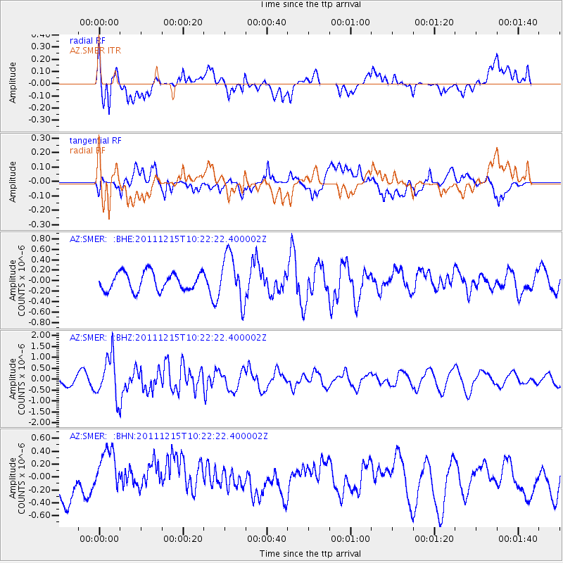
SMER AZ.SMER - Earthquake Result Viewer
*The percent match for this event was below the threshold and hence no stack was calculated.
| Earthquake location: |
South Of Kermadec Islands |
| Earthquake latitude/longitude: |
-32.7/-179.1 |
| Earthquake time(UTC): |
2011/12/15 (349) 10:10:07 GMT |
| Earthquake Depth: |
32 km |
| Earthquake Magnitude: |
5.8 MB, 5.7 MS, 6.0 MW, 5.9 MW |
| Earthquake Catalog/Contributor: |
WHDF/NEIC |
|
| Network: |
AZ ANZA Regional Network |
| Station: |
SMER AZ.SMER |
| Lat/Lon: |
33.46 N/117.17 W |
| Elevation: |
355 m |
|
| Distance: |
87.9 deg |
| Az: |
47.573 deg |
| Baz: |
228.1 deg |
| Ray Param: |
$rayparam |
*The percent match for this event was below the threshold and hence was not used in the summary stack. |
|
| Radial Match: |
64.50709 % |
| Radial Bump: |
400 |
| Transverse Match: |
55.84152 % |
| Transverse Bump: |
400 |
| SOD ConfigId: |
434841 |
| Insert Time: |
2012-03-10 07:05:25.243 +0000 |
| GWidth: |
2.5 |
| Max Bumps: |
400 |
| Tol: |
0.001 |
|
Signal To Noise
| Channel | StoN | STA | LTA |
| AZ:SMER: :BHZ:20111215T10:22:22.400002Z | 2.918889 | 9.781314E-7 | 3.35104E-7 |
| AZ:SMER: :BHN:20111215T10:22:22.400002Z | 1.394388 | 4.0725337E-7 | 2.9206606E-7 |
| AZ:SMER: :BHE:20111215T10:22:22.400002Z | 2.742568 | 4.69264E-7 | 1.7110386E-7 |
| Arrivals |
| Ps | |
| PpPs | |
| PsPs/PpSs | |


