You are here: Home > Network List > CI - Caltech Regional Seismic Network Stations List
> Station NEE2 Needles Airport > Earthquake Result Viewer
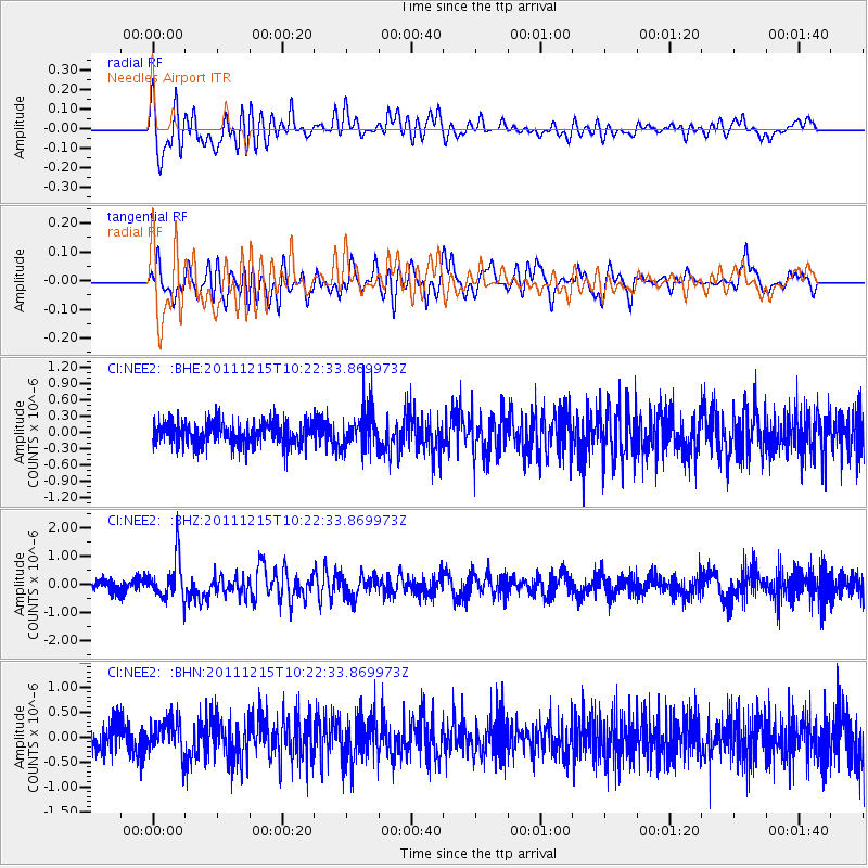
NEE2 Needles Airport - Earthquake Result Viewer
*The percent match for this event was below the threshold and hence no stack was calculated.
| Earthquake location: |
South Of Kermadec Islands |
| Earthquake latitude/longitude: |
-32.7/-179.1 |
| Earthquake time(UTC): |
2011/12/15 (349) 10:10:07 GMT |
| Earthquake Depth: |
32 km |
| Earthquake Magnitude: |
5.8 MB, 5.7 MS, 6.0 MW, 5.9 MW |
| Earthquake Catalog/Contributor: |
WHDF/NEIC |
|
| Network: |
CI Caltech Regional Seismic Network |
| Station: |
NEE2 Needles Airport |
| Lat/Lon: |
34.77 N/114.62 W |
| Elevation: |
271 m |
|
| Distance: |
90.4 deg |
| Az: |
47.984 deg |
| Baz: |
229.531 deg |
| Ray Param: |
$rayparam |
*The percent match for this event was below the threshold and hence was not used in the summary stack. |
|
| Radial Match: |
58.9057 % |
| Radial Bump: |
400 |
| Transverse Match: |
65.09804 % |
| Transverse Bump: |
400 |
| SOD ConfigId: |
434841 |
| Insert Time: |
2012-03-10 07:09:18.235 +0000 |
| GWidth: |
2.5 |
| Max Bumps: |
400 |
| Tol: |
0.001 |
|
Signal To Noise
| Channel | StoN | STA | LTA |
| CI:NEE2: :BHZ:20111215T10:22:33.869973Z | 3.2600129 | 6.9155703E-7 | 2.1213323E-7 |
| CI:NEE2: :BHN:20111215T10:22:33.869973Z | 1.2290004 | 3.3447338E-7 | 2.7215074E-7 |
| CI:NEE2: :BHE:20111215T10:22:33.869973Z | 1.6873754 | 3.585211E-7 | 2.1247264E-7 |
| Arrivals |
| Ps | |
| PpPs | |
| PsPs/PpSs | |


