You are here: Home > Network List > CI - Caltech Regional Seismic Network Stations List
> Station DAN Danby, California, USA > Earthquake Result Viewer
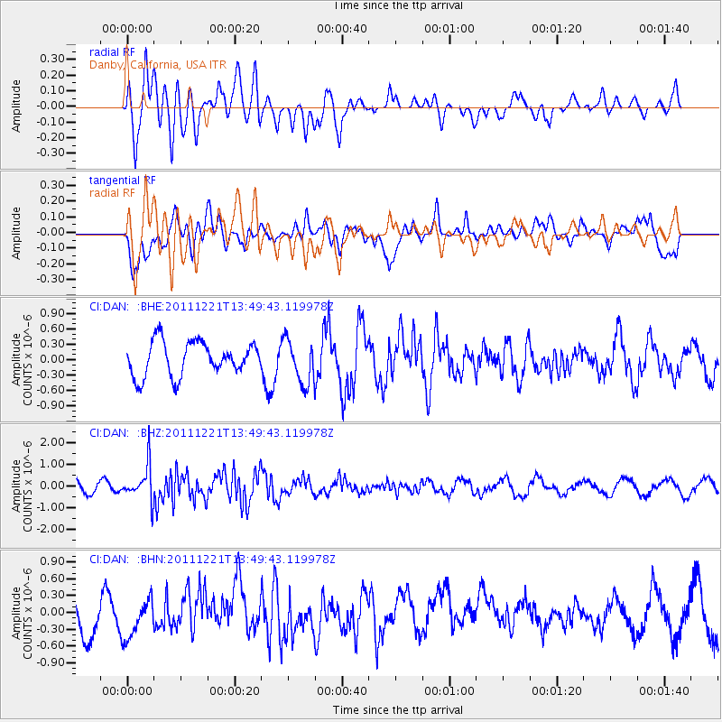
DAN Danby, California, USA - Earthquake Result Viewer
*The percent match for this event was below the threshold and hence no stack was calculated.
| Earthquake location: |
South Of Kermadec Islands |
| Earthquake latitude/longitude: |
-33.2/-179.0 |
| Earthquake time(UTC): |
2011/12/21 (355) 13:37:14 GMT |
| Earthquake Depth: |
10 km |
| Earthquake Magnitude: |
5.6 MB, 5.4 MS, 5.5 MW, 5.7 MW |
| Earthquake Catalog/Contributor: |
WHDF/NEIC |
|
| Network: |
CI Caltech Regional Seismic Network |
| Station: |
DAN Danby, California, USA |
| Lat/Lon: |
34.64 N/115.38 W |
| Elevation: |
398 m |
|
| Distance: |
90.1 deg |
| Az: |
47.629 deg |
| Baz: |
228.72 deg |
| Ray Param: |
$rayparam |
*The percent match for this event was below the threshold and hence was not used in the summary stack. |
|
| Radial Match: |
77.07678 % |
| Radial Bump: |
400 |
| Transverse Match: |
56.278236 % |
| Transverse Bump: |
400 |
| SOD ConfigId: |
434841 |
| Insert Time: |
2012-03-13 20:48:19.127 +0000 |
| GWidth: |
2.5 |
| Max Bumps: |
400 |
| Tol: |
0.001 |
|
Signal To Noise
| Channel | StoN | STA | LTA |
| CI:DAN: :BHZ:20111221T13:49:43.119978Z | 1.7641534 | 8.2318974E-7 | 4.666203E-7 |
| CI:DAN: :BHN:20111221T13:49:43.119978Z | 0.99281996 | 3.7041116E-7 | 3.7308996E-7 |
| CI:DAN: :BHE:20111221T13:49:43.119978Z | 1.3124977 | 4.284523E-7 | 3.2644041E-7 |
| Arrivals |
| Ps | |
| PpPs | |
| PsPs/PpSs | |


