You are here: Home > Network List > BK - Berkeley Digital Seismograph Network Stations List
> Station HUMO Hull Mountain, OR > Earthquake Result Viewer
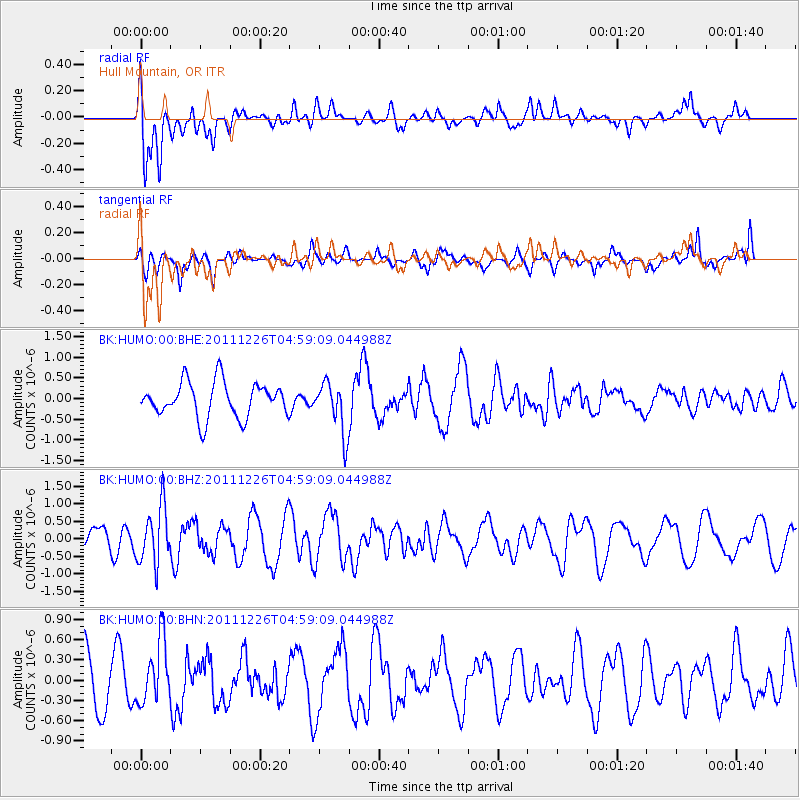
HUMO Hull Mountain, OR - Earthquake Result Viewer
*The percent match for this event was below the threshold and hence no stack was calculated.
| Earthquake location: |
Tonga Islands |
| Earthquake latitude/longitude: |
-16.2/-173.9 |
| Earthquake time(UTC): |
2011/12/26 (360) 04:48:08 GMT |
| Earthquake Depth: |
90 km |
| Earthquake Magnitude: |
5.8 MB, 6.0 MW, 6.0 MW |
| Earthquake Catalog/Contributor: |
WHDF/NEIC |
|
| Network: |
BK Berkeley Digital Seismograph Network |
| Station: |
HUMO Hull Mountain, OR |
| Lat/Lon: |
42.61 N/122.96 W |
| Elevation: |
555 m |
|
| Distance: |
74.9 deg |
| Az: |
36.401 deg |
| Baz: |
230.562 deg |
| Ray Param: |
$rayparam |
*The percent match for this event was below the threshold and hence was not used in the summary stack. |
|
| Radial Match: |
66.0799 % |
| Radial Bump: |
400 |
| Transverse Match: |
56.05178 % |
| Transverse Bump: |
338 |
| SOD ConfigId: |
434841 |
| Insert Time: |
2012-03-15 04:31:37.129 +0000 |
| GWidth: |
2.5 |
| Max Bumps: |
400 |
| Tol: |
0.001 |
|
Signal To Noise
| Channel | StoN | STA | LTA |
| BK:HUMO:00:BHZ:20111226T04:59:09.044988Z | 2.1520298 | 8.1091537E-7 | 3.7681417E-7 |
| BK:HUMO:00:BHN:20111226T04:59:09.044988Z | 0.94879925 | 4.6916378E-7 | 4.9448164E-7 |
| BK:HUMO:00:BHE:20111226T04:59:09.044988Z | 1.4620167 | 6.178874E-7 | 4.2262675E-7 |
| Arrivals |
| Ps | |
| PpPs | |
| PsPs/PpSs | |


