You are here: Home > Network List > CI - Caltech Regional Seismic Network Stations List
> Station MPM Manuel Prospect Mine, California, USA > Earthquake Result Viewer
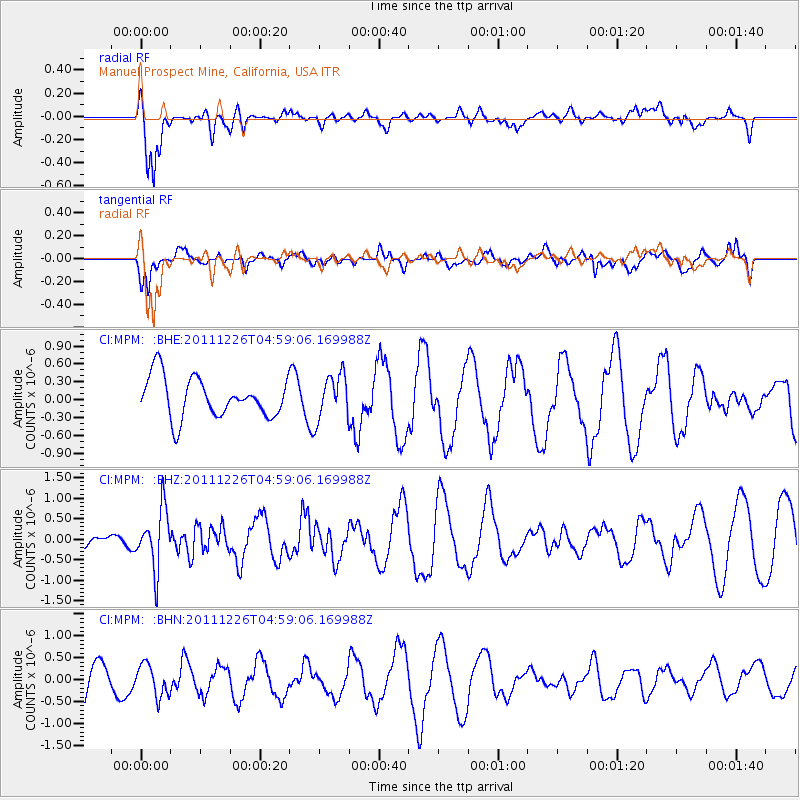
MPM Manuel Prospect Mine, California, USA - Earthquake Result Viewer
*The percent match for this event was below the threshold and hence no stack was calculated.
| Earthquake location: |
Tonga Islands |
| Earthquake latitude/longitude: |
-16.2/-173.9 |
| Earthquake time(UTC): |
2011/12/26 (360) 04:48:08 GMT |
| Earthquake Depth: |
90 km |
| Earthquake Magnitude: |
5.8 MB, 6.0 MW, 6.0 MW |
| Earthquake Catalog/Contributor: |
WHDF/NEIC |
|
| Network: |
CI Caltech Regional Seismic Network |
| Station: |
MPM Manuel Prospect Mine, California, USA |
| Lat/Lon: |
36.06 N/117.49 W |
| Elevation: |
185 m |
|
| Distance: |
74.4 deg |
| Az: |
44.464 deg |
| Baz: |
236.156 deg |
| Ray Param: |
$rayparam |
*The percent match for this event was below the threshold and hence was not used in the summary stack. |
|
| Radial Match: |
76.630455 % |
| Radial Bump: |
400 |
| Transverse Match: |
51.496777 % |
| Transverse Bump: |
356 |
| SOD ConfigId: |
434841 |
| Insert Time: |
2012-03-15 04:32:36.020 +0000 |
| GWidth: |
2.5 |
| Max Bumps: |
400 |
| Tol: |
0.001 |
|
Signal To Noise
| Channel | StoN | STA | LTA |
| CI:MPM: :BHZ:20111226T04:59:06.169988Z | 2.0421877 | 7.1963706E-7 | 3.5238537E-7 |
| CI:MPM: :BHN:20111226T04:59:06.169988Z | 1.0365306 | 3.6027555E-7 | 3.4757832E-7 |
| CI:MPM: :BHE:20111226T04:59:06.169988Z | 1.1282651 | 3.7917138E-7 | 3.3606585E-7 |
| Arrivals |
| Ps | |
| PpPs | |
| PsPs/PpSs | |


