You are here: Home > Network List > CI - Caltech Regional Seismic Network Stations List
> Station SLA SLA, Trona, CA, USA > Earthquake Result Viewer
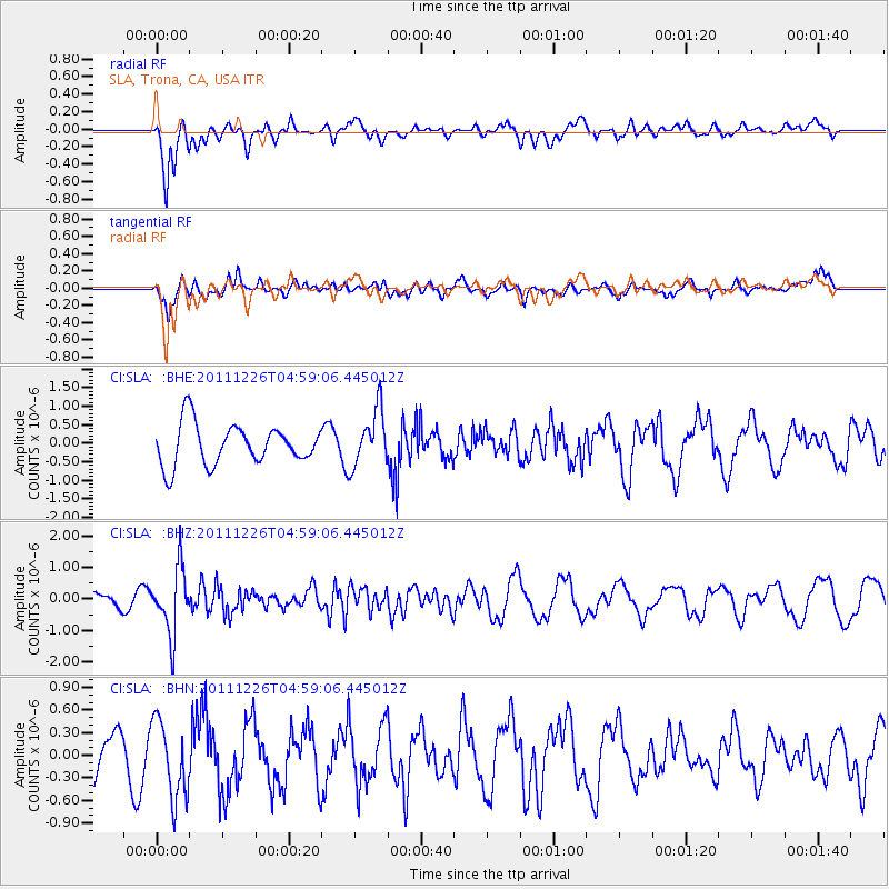
SLA SLA, Trona, CA, USA - Earthquake Result Viewer
*The percent match for this event was below the threshold and hence no stack was calculated.
| Earthquake location: |
Tonga Islands |
| Earthquake latitude/longitude: |
-16.2/-173.9 |
| Earthquake time(UTC): |
2011/12/26 (360) 04:48:08 GMT |
| Earthquake Depth: |
90 km |
| Earthquake Magnitude: |
5.8 MB, 6.0 MW, 6.0 MW |
| Earthquake Catalog/Contributor: |
WHDF/NEIC |
|
| Network: |
CI Caltech Regional Seismic Network |
| Station: |
SLA SLA, Trona, CA, USA |
| Lat/Lon: |
35.89 N/117.28 W |
| Elevation: |
1174 m |
|
| Distance: |
74.5 deg |
| Az: |
44.704 deg |
| Baz: |
236.341 deg |
| Ray Param: |
$rayparam |
*The percent match for this event was below the threshold and hence was not used in the summary stack. |
|
| Radial Match: |
66.64365 % |
| Radial Bump: |
400 |
| Transverse Match: |
69.53581 % |
| Transverse Bump: |
400 |
| SOD ConfigId: |
434841 |
| Insert Time: |
2012-03-15 04:32:54.050 +0000 |
| GWidth: |
2.5 |
| Max Bumps: |
400 |
| Tol: |
0.001 |
|
Signal To Noise
| Channel | StoN | STA | LTA |
| CI:SLA: :BHZ:20111226T04:59:06.445012Z | 3.3476567 | 1.0422715E-6 | 3.113436E-7 |
| CI:SLA: :BHN:20111226T04:59:06.445012Z | 1.6010469 | 5.109759E-7 | 3.1915113E-7 |
| CI:SLA: :BHE:20111226T04:59:06.445012Z | 1.3959668 | 7.642577E-7 | 5.474756E-7 |
| Arrivals |
| Ps | |
| PpPs | |
| PsPs/PpSs | |


