You are here: Home > Network List > CI - Caltech Regional Seismic Network Stations List
> Station SMM Simmler, CA, USA > Earthquake Result Viewer
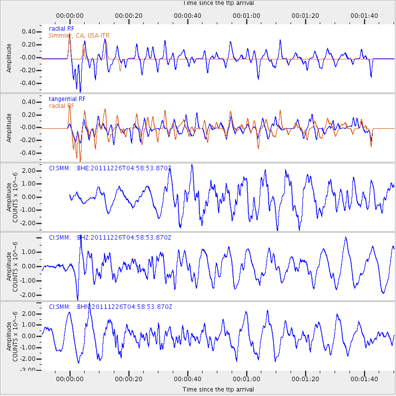
SMM Simmler, CA, USA - Earthquake Result Viewer
*The percent match for this event was below the threshold and hence no stack was calculated.
| Earthquake location: |
Tonga Islands |
| Earthquake latitude/longitude: |
-16.2/-173.9 |
| Earthquake time(UTC): |
2011/12/26 (360) 04:48:08 GMT |
| Earthquake Depth: |
90 km |
| Earthquake Magnitude: |
5.8 MB, 6.0 MW, 6.0 MW |
| Earthquake Catalog/Contributor: |
WHDF/NEIC |
|
| Network: |
CI Caltech Regional Seismic Network |
| Station: |
SMM Simmler, CA, USA |
| Lat/Lon: |
35.31 N/120.00 W |
| Elevation: |
599 m |
|
| Distance: |
72.3 deg |
| Az: |
43.89 deg |
| Baz: |
234.536 deg |
| Ray Param: |
$rayparam |
*The percent match for this event was below the threshold and hence was not used in the summary stack. |
|
| Radial Match: |
70.841225 % |
| Radial Bump: |
400 |
| Transverse Match: |
36.29403 % |
| Transverse Bump: |
367 |
| SOD ConfigId: |
434841 |
| Insert Time: |
2012-03-15 04:33:17.858 +0000 |
| GWidth: |
2.5 |
| Max Bumps: |
400 |
| Tol: |
0.001 |
|
Signal To Noise
| Channel | StoN | STA | LTA |
| CI:SMM: :BHZ:20111226T04:58:53.870Z | 2.876115 | 9.934674E-7 | 3.4541992E-7 |
| CI:SMM: :BHN:20111226T04:58:53.870Z | 4.0895495 | 1.5797029E-6 | 3.86278E-7 |
| CI:SMM: :BHE:20111226T04:58:53.870Z | 2.7639928 | 1.2513259E-6 | 4.52724E-7 |
| Arrivals |
| Ps | |
| PpPs | |
| PsPs/PpSs | |


