You are here: Home > Network List > IC - New China Digital Seismograph Network Stations List
> Station ENH Enshi, Hubei Province, China > Earthquake Result Viewer
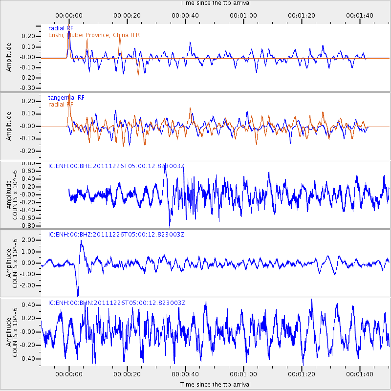
ENH Enshi, Hubei Province, China - Earthquake Result Viewer
*The percent match for this event was below the threshold and hence no stack was calculated.
| Earthquake location: |
Tonga Islands |
| Earthquake latitude/longitude: |
-16.2/-173.9 |
| Earthquake time(UTC): |
2011/12/26 (360) 04:48:08 GMT |
| Earthquake Depth: |
90 km |
| Earthquake Magnitude: |
5.8 MB, 6.0 MW, 6.0 MW |
| Earthquake Catalog/Contributor: |
WHDF/NEIC |
|
| Network: |
IC New China Digital Seismograph Network |
| Station: |
ENH Enshi, Hubei Province, China |
| Lat/Lon: |
30.28 N/109.49 E |
| Elevation: |
500 m |
|
| Distance: |
87.0 deg |
| Az: |
302.557 deg |
| Baz: |
110.589 deg |
| Ray Param: |
$rayparam |
*The percent match for this event was below the threshold and hence was not used in the summary stack. |
|
| Radial Match: |
69.57605 % |
| Radial Bump: |
400 |
| Transverse Match: |
67.6927 % |
| Transverse Bump: |
400 |
| SOD ConfigId: |
434841 |
| Insert Time: |
2012-03-15 04:35:28.283 +0000 |
| GWidth: |
2.5 |
| Max Bumps: |
400 |
| Tol: |
0.001 |
|
Signal To Noise
| Channel | StoN | STA | LTA |
| IC:ENH:00:BHZ:20111226T05:00:12.823003Z | 6.6137586 | 1.190475E-6 | 1.7999977E-7 |
| IC:ENH:00:BHN:20111226T05:00:12.823003Z | 1.423363 | 1.6801728E-7 | 1.1804247E-7 |
| IC:ENH:00:BHE:20111226T05:00:12.823003Z | 3.0589645 | 3.6947222E-7 | 1.2078343E-7 |
| Arrivals |
| Ps | |
| PpPs | |
| PsPs/PpSs | |


