You are here: Home > Network List > IW - Intermountain West Stations List
> Station DLMT Dillon, Montana, USA > Earthquake Result Viewer
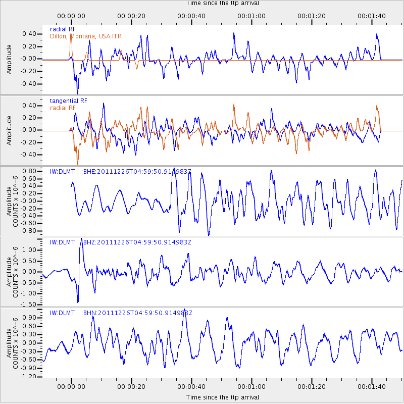
DLMT Dillon, Montana, USA - Earthquake Result Viewer
*The percent match for this event was below the threshold and hence no stack was calculated.
| Earthquake location: |
Tonga Islands |
| Earthquake latitude/longitude: |
-16.2/-173.9 |
| Earthquake time(UTC): |
2011/12/26 (360) 04:48:08 GMT |
| Earthquake Depth: |
90 km |
| Earthquake Magnitude: |
5.8 MB, 6.0 MW, 6.0 MW |
| Earthquake Catalog/Contributor: |
WHDF/NEIC |
|
| Network: |
IW Intermountain West |
| Station: |
DLMT Dillon, Montana, USA |
| Lat/Lon: |
45.36 N/112.60 W |
| Elevation: |
1569 m |
|
| Distance: |
82.6 deg |
| Az: |
38.565 deg |
| Baz: |
238.167 deg |
| Ray Param: |
$rayparam |
*The percent match for this event was below the threshold and hence was not used in the summary stack. |
|
| Radial Match: |
72.49375 % |
| Radial Bump: |
400 |
| Transverse Match: |
54.643047 % |
| Transverse Bump: |
400 |
| SOD ConfigId: |
434841 |
| Insert Time: |
2012-03-15 04:37:41.490 +0000 |
| GWidth: |
2.5 |
| Max Bumps: |
400 |
| Tol: |
0.001 |
|
Signal To Noise
| Channel | StoN | STA | LTA |
| IW:DLMT: :BHZ:20111226T04:59:50.914983Z | 5.4986844 | 7.7944685E-7 | 1.4175151E-7 |
| IW:DLMT: :BHN:20111226T04:59:50.914983Z | 0.74810743 | 2.6894702E-7 | 3.5950322E-7 |
| IW:DLMT: :BHE:20111226T04:59:50.914983Z | 1.8951042 | 4.3029883E-7 | 2.2705814E-7 |
| Arrivals |
| Ps | |
| PpPs | |
| PsPs/PpSs | |


