You are here: Home > Network List > TA - USArray Transportable Network (new EarthScope stations) Stations List
> Station A04D Lummi Island, WA, USA > Earthquake Result Viewer
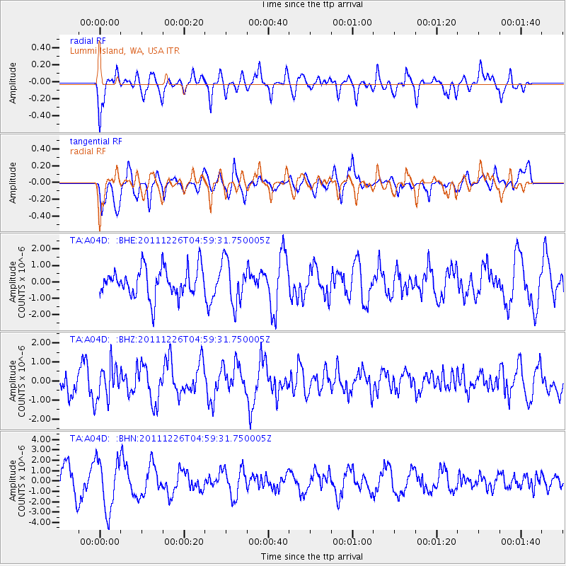
A04D Lummi Island, WA, USA - Earthquake Result Viewer
*The percent match for this event was below the threshold and hence no stack was calculated.
| Earthquake location: |
Tonga Islands |
| Earthquake latitude/longitude: |
-16.2/-173.9 |
| Earthquake time(UTC): |
2011/12/26 (360) 04:48:08 GMT |
| Earthquake Depth: |
90 km |
| Earthquake Magnitude: |
5.8 MB, 6.0 MW, 6.0 MW |
| Earthquake Catalog/Contributor: |
WHDF/NEIC |
|
| Network: |
TA USArray Transportable Network (new EarthScope stations) |
| Station: |
A04D Lummi Island, WA, USA |
| Lat/Lon: |
48.72 N/122.71 W |
| Elevation: |
13 m |
|
| Distance: |
79.0 deg |
| Az: |
31.702 deg |
| Baz: |
229.677 deg |
| Ray Param: |
$rayparam |
*The percent match for this event was below the threshold and hence was not used in the summary stack. |
|
| Radial Match: |
48.909824 % |
| Radial Bump: |
400 |
| Transverse Match: |
61.0212 % |
| Transverse Bump: |
400 |
| SOD ConfigId: |
434841 |
| Insert Time: |
2012-03-15 04:45:19.252 +0000 |
| GWidth: |
2.5 |
| Max Bumps: |
400 |
| Tol: |
0.001 |
|
Signal To Noise
| Channel | StoN | STA | LTA |
| TA:A04D: :BHZ:20111226T04:59:31.750005Z | 1.2059803 | 8.352883E-7 | 6.926218E-7 |
| TA:A04D: :BHN:20111226T04:59:31.750005Z | 2.0978484 | 2.475009E-6 | 1.1797846E-6 |
| TA:A04D: :BHE:20111226T04:59:31.750005Z | 1.5638248 | 1.3472636E-6 | 8.615183E-7 |
| Arrivals |
| Ps | |
| PpPs | |
| PsPs/PpSs | |


