You are here: Home > Network List > TA - USArray Transportable Network (new EarthScope stations) Stations List
> Station I36A Fitzsimmons Farm, Good Thunder, MN, USA > Earthquake Result Viewer
I36A Fitzsimmons Farm, Good Thunder, MN, USA - Earthquake Result Viewer
*The percent match for this event was below the threshold and hence no stack was calculated.
| Earthquake location: |
Tonga Islands |
| Earthquake latitude/longitude: |
-16.2/-173.9 |
| Earthquake time(UTC): |
2011/12/26 (360) 04:48:08 GMT |
| Earthquake Depth: |
90 km |
| Earthquake Magnitude: |
5.8 MB, 6.0 MW, 6.0 MW |
| Earthquake Catalog/Contributor: |
WHDF/NEIC |
|
| Network: |
TA USArray Transportable Network (new EarthScope stations) |
| Station: |
I36A Fitzsimmons Farm, Good Thunder, MN, USA |
| Lat/Lon: |
44.02 N/94.01 W |
| Elevation: |
307 m |
|
| Distance: |
94.0 deg |
| Az: |
45.388 deg |
| Baz: |
251.454 deg |
| Ray Param: |
$rayparam |
*The percent match for this event was below the threshold and hence was not used in the summary stack. |
|
| Radial Match: |
66.80157 % |
| Radial Bump: |
400 |
| Transverse Match: |
58.323505 % |
| Transverse Bump: |
400 |
| SOD ConfigId: |
434841 |
| Insert Time: |
2012-03-15 04:46:31.735 +0000 |
| GWidth: |
2.5 |
| Max Bumps: |
400 |
| Tol: |
0.001 |
|
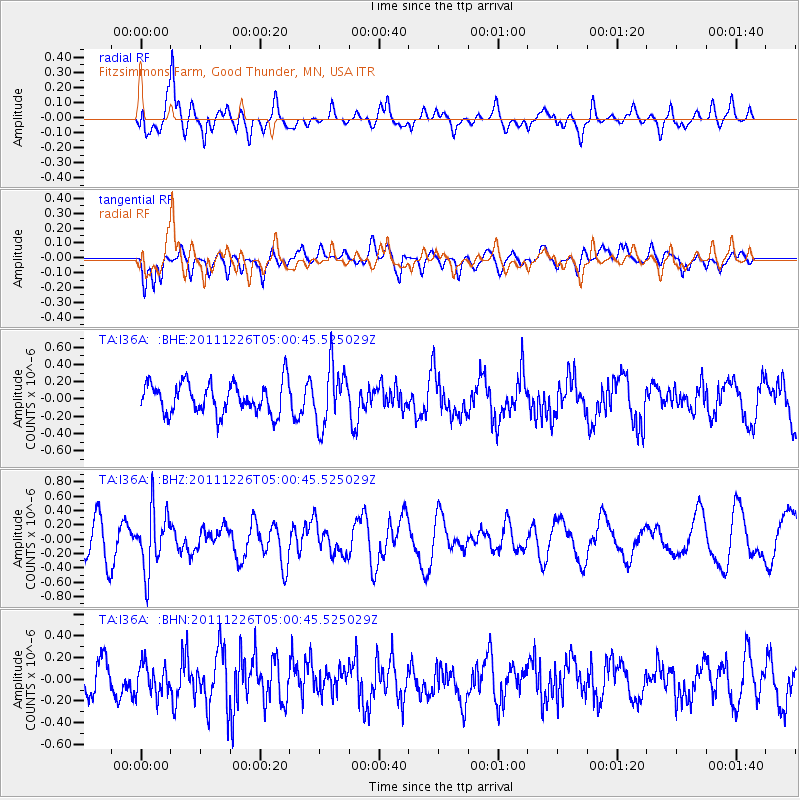
Signal To Noise
| Channel | StoN | STA | LTA |
| TA:I36A: :BHZ:20111226T05:00:45.525029Z | 1.7426282 | 4.1591375E-7 | 2.3867037E-7 |
| TA:I36A: :BHN:20111226T05:00:45.525029Z | 0.8808541 | 1.385008E-7 | 1.5723465E-7 |
| TA:I36A: :BHE:20111226T05:00:45.525029Z | 1.865166 | 3.333705E-7 | 1.7873504E-7 |
| Arrivals |
| Ps | |
| PpPs | |
| PsPs/PpSs | |


