You are here: Home > Network List > TA - USArray Transportable Network (new EarthScope stations) Stations List
> Station H37A Dierke Farm, Cannon Falls, MN, USA > Earthquake Result Viewer
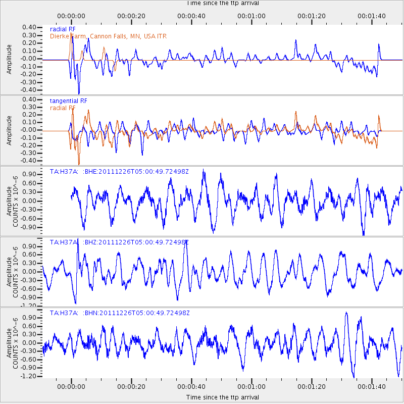
H37A Dierke Farm, Cannon Falls, MN, USA - Earthquake Result Viewer
*The percent match for this event was below the threshold and hence no stack was calculated.
| Earthquake location: |
Tonga Islands |
| Earthquake latitude/longitude: |
-16.2/-173.9 |
| Earthquake time(UTC): |
2011/12/26 (360) 04:48:08 GMT |
| Earthquake Depth: |
90 km |
| Earthquake Magnitude: |
5.8 MB, 6.0 MW, 6.0 MW |
| Earthquake Catalog/Contributor: |
WHDF/NEIC |
|
| Network: |
TA USArray Transportable Network (new EarthScope stations) |
| Station: |
H37A Dierke Farm, Cannon Falls, MN, USA |
| Lat/Lon: |
44.58 N/92.92 W |
| Elevation: |
321 m |
|
| Distance: |
94.9 deg |
| Az: |
45.098 deg |
| Baz: |
252.24 deg |
| Ray Param: |
$rayparam |
*The percent match for this event was below the threshold and hence was not used in the summary stack. |
|
| Radial Match: |
60.00575 % |
| Radial Bump: |
400 |
| Transverse Match: |
56.673283 % |
| Transverse Bump: |
398 |
| SOD ConfigId: |
434841 |
| Insert Time: |
2012-03-15 04:46:51.588 +0000 |
| GWidth: |
2.5 |
| Max Bumps: |
400 |
| Tol: |
0.001 |
|
Signal To Noise
| Channel | StoN | STA | LTA |
| TA:H37A: :BHZ:20111226T05:00:49.72498Z | 1.8496343 | 5.706123E-7 | 3.0850006E-7 |
| TA:H37A: :BHN:20111226T05:00:49.72498Z | 0.7070062 | 2.6933395E-7 | 3.8094987E-7 |
| TA:H37A: :BHE:20111226T05:00:49.72498Z | 1.3537937 | 4.7610305E-7 | 3.5168065E-7 |
| Arrivals |
| Ps | |
| PpPs | |
| PsPs/PpSs | |


