You are here: Home > Network List > TA - USArray Transportable Network (new EarthScope stations) Stations List
> Station T47A Sharon Grove, KY, USA > Earthquake Result Viewer
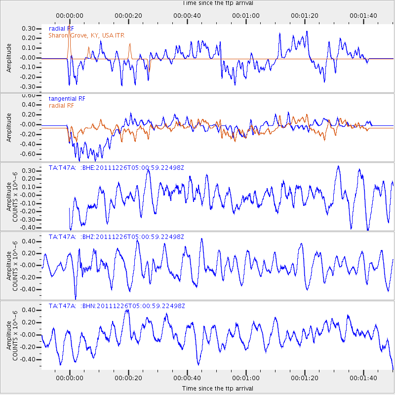
T47A Sharon Grove, KY, USA - Earthquake Result Viewer
*The percent match for this event was below the threshold and hence no stack was calculated.
| Earthquake location: |
Tonga Islands |
| Earthquake latitude/longitude: |
-16.2/-173.9 |
| Earthquake time(UTC): |
2011/12/26 (360) 04:48:08 GMT |
| Earthquake Depth: |
90 km |
| Earthquake Magnitude: |
5.8 MB, 6.0 MW, 6.0 MW |
| Earthquake Catalog/Contributor: |
WHDF/NEIC |
|
| Network: |
TA USArray Transportable Network (new EarthScope stations) |
| Station: |
T47A Sharon Grove, KY, USA |
| Lat/Lon: |
36.99 N/87.11 W |
| Elevation: |
217 m |
|
| Distance: |
97.0 deg |
| Az: |
53.657 deg |
| Baz: |
255.139 deg |
| Ray Param: |
$rayparam |
*The percent match for this event was below the threshold and hence was not used in the summary stack. |
|
| Radial Match: |
48.120678 % |
| Radial Bump: |
400 |
| Transverse Match: |
40.48243 % |
| Transverse Bump: |
400 |
| SOD ConfigId: |
434841 |
| Insert Time: |
2012-03-15 04:54:36.867 +0000 |
| GWidth: |
2.5 |
| Max Bumps: |
400 |
| Tol: |
0.001 |
|
Signal To Noise
| Channel | StoN | STA | LTA |
| TA:T47A: :BHZ:20111226T05:00:59.22498Z | 1.4194036 | 2.1640058E-7 | 1.5245881E-7 |
| TA:T47A: :BHN:20111226T05:00:59.22498Z | 1.3916793 | 2.8615665E-7 | 2.0561967E-7 |
| TA:T47A: :BHE:20111226T05:00:59.22498Z | 1.177165 | 1.6687697E-7 | 1.4176175E-7 |
| Arrivals |
| Ps | |
| PpPs | |
| PsPs/PpSs | |


