S44A Carbondale, IL, USA - Earthquake Result Viewer
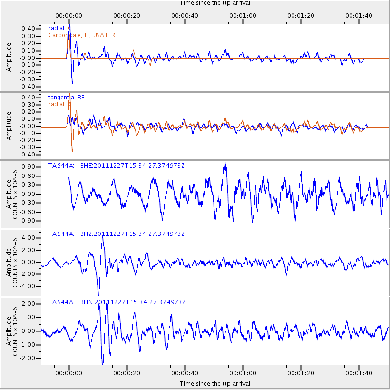
Earthquake location: Southwestern Siberia, Russia
Earthquake latitude/longitude: 51.8/95.9
Earthquake time(UTC): 2011/12/27 (361) 15:21:56 GMT
Earthquake Depth: 15 km
Earthquake Magnitude: 6.1 MB, 6.7 MS, 6.6 MW, 6.6 MW
Earthquake Catalog/Contributor: WHDF/NEIC
Network: TA USArray Transportable Network (new EarthScope stations)
Station: S44A Carbondale, IL, USA
Lat/Lon: 37.69 N/89.26 W
Elevation: 155 m
Distance: 90.7 deg
Az: 4.096 deg
Baz: 356.797 deg
Ray Param: 0.041652244
Estimated Moho Depth: 31.25 km
Estimated Crust Vp/Vs: 1.60
Assumed Crust Vp: 6.444 km/s
Estimated Crust Vs: 4.027 km/s
Estimated Crust Poisson's Ratio: 0.18
Radial Match: 81.91045 %
Radial Bump: 400
Transverse Match: 62.928253 %
Transverse Bump: 400
SOD ConfigId: 434841
Insert Time: 2012-03-15 05:27:27.943 +0000
GWidth: 2.5
Max Bumps: 400
Tol: 0.001

Signal To Noise

ChannelStoNSTALTA
TA:S44A: :BHZ:20111227T15:34:27.374973Z2.14459786.6696344E-73.1099697E-7
TA:S44A: :BHN:20111227T15:34:27.374973Z1.8826684.5919774E-72.4390798E-7
TA:S44A: :BHE:20111227T15:34:27.374973Z1.81345934.3295958E-72.387479E-7
Arrivals
Ps3.0 SECOND
PpPs12 SECOND
PsPs/PpSs15 SECOND