You are here: Home > Network List > CI - Caltech Regional Seismic Network Stations List
> Station SMM Simmler, CA, USA > Earthquake Result Viewer
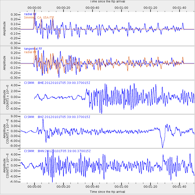
SMM Simmler, CA, USA - Earthquake Result Viewer
*The percent match for this event was below the threshold and hence no stack was calculated.
| Earthquake location: |
Southeast Of Honshu, Japan |
| Earthquake latitude/longitude: |
31.5/138.1 |
| Earthquake time(UTC): |
2012/01/01 (001) 05:27:55 GMT |
| Earthquake Depth: |
365 km |
| Earthquake Magnitude: |
6.2 MB, 6.8 MW, 6.8 MW |
| Earthquake Catalog/Contributor: |
WHDF/NEIC |
|
| Network: |
CI Caltech Regional Seismic Network |
| Station: |
SMM Simmler, CA, USA |
| Lat/Lon: |
35.31 N/120.00 W |
| Elevation: |
599 m |
|
| Distance: |
81.1 deg |
| Az: |
54.082 deg |
| Baz: |
302.192 deg |
| Ray Param: |
$rayparam |
*The percent match for this event was below the threshold and hence was not used in the summary stack. |
|
| Radial Match: |
54.274246 % |
| Radial Bump: |
400 |
| Transverse Match: |
62.422066 % |
| Transverse Bump: |
400 |
| SOD ConfigId: |
434841 |
| Insert Time: |
2012-03-18 07:50:42.633 +0000 |
| GWidth: |
2.5 |
| Max Bumps: |
400 |
| Tol: |
0.001 |
|
Signal To Noise
| Channel | StoN | STA | LTA |
| CI:SMM: :BHZ:20120101T05:39:00.370015Z | 3.2550237 | 9.98107E-7 | 3.0663585E-7 |
| CI:SMM: :BHN:20120101T05:39:00.370015Z | 0.8923471 | 5.2085517E-7 | 5.836912E-7 |
| CI:SMM: :BHE:20120101T05:39:00.370015Z | 1.2921741 | 5.2169463E-7 | 4.0373405E-7 |
| Arrivals |
| Ps | |
| PpPs | |
| PsPs/PpSs | |


