You are here: Home > Network List > TA - USArray Transportable Network (new EarthScope stations) Stations List
> Station TUL1 Leonard, OK, USA > Earthquake Result Viewer
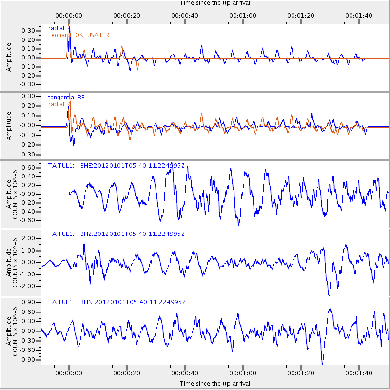
TUL1 Leonard, OK, USA - Earthquake Result Viewer
*The percent match for this event was below the threshold and hence no stack was calculated.
| Earthquake location: |
Southeast Of Honshu, Japan |
| Earthquake latitude/longitude: |
31.5/138.1 |
| Earthquake time(UTC): |
2012/01/01 (001) 05:27:55 GMT |
| Earthquake Depth: |
365 km |
| Earthquake Magnitude: |
6.2 MB, 6.8 MW, 6.8 MW |
| Earthquake Catalog/Contributor: |
WHDF/NEIC |
|
| Network: |
TA USArray Transportable Network (new EarthScope stations) |
| Station: |
TUL1 Leonard, OK, USA |
| Lat/Lon: |
35.91 N/95.79 W |
| Elevation: |
256 m |
|
| Distance: |
96.1 deg |
| Az: |
41.249 deg |
| Baz: |
316.045 deg |
| Ray Param: |
$rayparam |
*The percent match for this event was below the threshold and hence was not used in the summary stack. |
|
| Radial Match: |
63.222084 % |
| Radial Bump: |
400 |
| Transverse Match: |
63.880306 % |
| Transverse Bump: |
400 |
| SOD ConfigId: |
434841 |
| Insert Time: |
2012-03-18 08:04:59.740 +0000 |
| GWidth: |
2.5 |
| Max Bumps: |
400 |
| Tol: |
0.001 |
|
Signal To Noise
| Channel | StoN | STA | LTA |
| TA:TUL1: :BHZ:20120101T05:40:11.224995Z | 1.943109 | 4.0810932E-7 | 2.1002904E-7 |
| TA:TUL1: :BHN:20120101T05:40:11.224995Z | 1.1303288 | 2.4602602E-7 | 2.1765881E-7 |
| TA:TUL1: :BHE:20120101T05:40:11.224995Z | 2.2778914 | 4.087331E-7 | 1.7943485E-7 |
| Arrivals |
| Ps | |
| PpPs | |
| PsPs/PpSs | |


