You are here: Home > Network List > TA - USArray Transportable Network (new EarthScope stations) Stations List
> Station G33A Ortonville, MN, USA > Earthquake Result Viewer
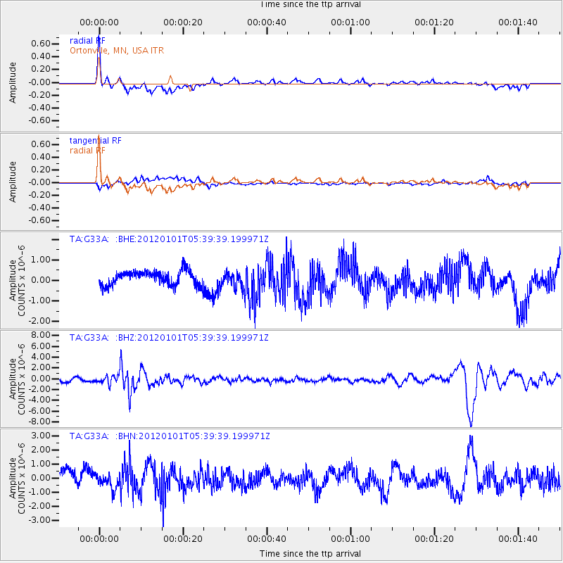
G33A Ortonville, MN, USA - Earthquake Result Viewer
*The percent match for this event was below the threshold and hence no stack was calculated.
| Earthquake location: |
Southeast Of Honshu, Japan |
| Earthquake latitude/longitude: |
31.5/138.1 |
| Earthquake time(UTC): |
2012/01/01 (001) 05:27:55 GMT |
| Earthquake Depth: |
365 km |
| Earthquake Magnitude: |
6.2 MB, 6.8 MW, 6.8 MW |
| Earthquake Catalog/Contributor: |
WHDF/NEIC |
|
| Network: |
TA USArray Transportable Network (new EarthScope stations) |
| Station: |
G33A Ortonville, MN, USA |
| Lat/Lon: |
45.19 N/96.44 W |
| Elevation: |
338 m |
|
| Distance: |
89.1 deg |
| Az: |
35.155 deg |
| Baz: |
315.899 deg |
| Ray Param: |
$rayparam |
*The percent match for this event was below the threshold and hence was not used in the summary stack. |
|
| Radial Match: |
62.46976 % |
| Radial Bump: |
400 |
| Transverse Match: |
35.780636 % |
| Transverse Bump: |
400 |
| SOD ConfigId: |
434841 |
| Insert Time: |
2012-03-18 08:13:38.563 +0000 |
| GWidth: |
2.5 |
| Max Bumps: |
400 |
| Tol: |
0.001 |
|
Signal To Noise
| Channel | StoN | STA | LTA |
| TA:G33A: :BHZ:20120101T05:39:39.199971Z | 1.6818238 | 7.413525E-7 | 4.408027E-7 |
| TA:G33A: :BHN:20120101T05:39:39.199971Z | 1.0397493 | 5.070319E-7 | 4.876483E-7 |
| TA:G33A: :BHE:20120101T05:39:39.199971Z | 1.1918534 | 4.1409965E-7 | 3.4744176E-7 |
| Arrivals |
| Ps | |
| PpPs | |
| PsPs/PpSs | |


