You are here: Home > Network List > TA - USArray Transportable Network (new EarthScope stations) Stations List
> Station C32A Crookston, MN, USA > Earthquake Result Viewer
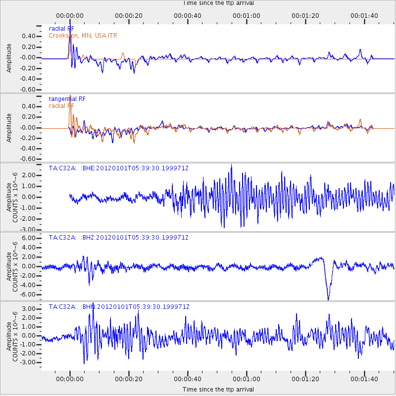
C32A Crookston, MN, USA - Earthquake Result Viewer
*The percent match for this event was below the threshold and hence no stack was calculated.
| Earthquake location: |
Southeast Of Honshu, Japan |
| Earthquake latitude/longitude: |
31.5/138.1 |
| Earthquake time(UTC): |
2012/01/01 (001) 05:27:55 GMT |
| Earthquake Depth: |
365 km |
| Earthquake Magnitude: |
6.2 MB, 6.8 MW, 6.8 MW |
| Earthquake Catalog/Contributor: |
WHDF/NEIC |
|
| Network: |
TA USArray Transportable Network (new EarthScope stations) |
| Station: |
C32A Crookston, MN, USA |
| Lat/Lon: |
47.83 N/96.53 W |
| Elevation: |
286 m |
|
| Distance: |
87.1 deg |
| Az: |
33.365 deg |
| Baz: |
315.775 deg |
| Ray Param: |
$rayparam |
*The percent match for this event was below the threshold and hence was not used in the summary stack. |
|
| Radial Match: |
58.965984 % |
| Radial Bump: |
400 |
| Transverse Match: |
41.560425 % |
| Transverse Bump: |
400 |
| SOD ConfigId: |
434841 |
| Insert Time: |
2012-03-18 08:14:31.168 +0000 |
| GWidth: |
2.5 |
| Max Bumps: |
400 |
| Tol: |
0.001 |
|
Signal To Noise
| Channel | StoN | STA | LTA |
| TA:C32A: :BHZ:20120101T05:39:30.199971Z | 2.6172514 | 8.275381E-7 | 3.1618595E-7 |
| TA:C32A: :BHN:20120101T05:39:30.199971Z | 2.0400918 | 7.241486E-7 | 3.5495887E-7 |
| TA:C32A: :BHE:20120101T05:39:30.199971Z | 1.8610399 | 4.3395707E-7 | 2.3317988E-7 |
| Arrivals |
| Ps | |
| PpPs | |
| PsPs/PpSs | |


