You are here: Home > Network List > TA - USArray Transportable Network (new EarthScope stations) Stations List
> Station F32A Veblen, SD, USA > Earthquake Result Viewer
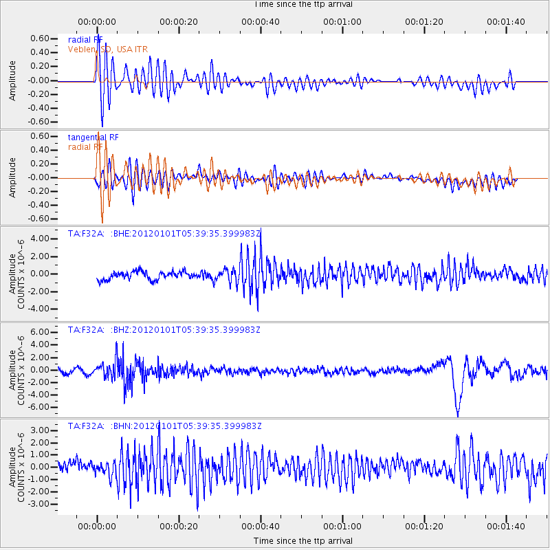
F32A Veblen, SD, USA - Earthquake Result Viewer
*The percent match for this event was below the threshold and hence no stack was calculated.
| Earthquake location: |
Southeast Of Honshu, Japan |
| Earthquake latitude/longitude: |
31.5/138.1 |
| Earthquake time(UTC): |
2012/01/01 (001) 05:27:55 GMT |
| Earthquake Depth: |
365 km |
| Earthquake Magnitude: |
6.2 MB, 6.8 MW, 6.8 MW |
| Earthquake Catalog/Contributor: |
WHDF/NEIC |
|
| Network: |
TA USArray Transportable Network (new EarthScope stations) |
| Station: |
F32A Veblen, SD, USA |
| Lat/Lon: |
45.87 N/97.13 W |
| Elevation: |
371 m |
|
| Distance: |
88.2 deg |
| Az: |
35.029 deg |
| Baz: |
315.407 deg |
| Ray Param: |
$rayparam |
*The percent match for this event was below the threshold and hence was not used in the summary stack. |
|
| Radial Match: |
73.641846 % |
| Radial Bump: |
400 |
| Transverse Match: |
64.46473 % |
| Transverse Bump: |
400 |
| SOD ConfigId: |
434841 |
| Insert Time: |
2012-03-18 08:14:37.724 +0000 |
| GWidth: |
2.5 |
| Max Bumps: |
400 |
| Tol: |
0.001 |
|
Signal To Noise
| Channel | StoN | STA | LTA |
| TA:F32A: :BHZ:20120101T05:39:35.399983Z | 3.854317 | 1.3783863E-6 | 3.5762142E-7 |
| TA:F32A: :BHN:20120101T05:39:35.399983Z | 1.2227212 | 5.348089E-7 | 4.3739234E-7 |
| TA:F32A: :BHE:20120101T05:39:35.399983Z | 1.5489494 | 6.9497025E-7 | 4.48672E-7 |
| Arrivals |
| Ps | |
| PpPs | |
| PsPs/PpSs | |


