You are here: Home > Network List > UW - Pacific Northwest Regional Seismic Network Stations List
> Station HOOD Mt Hood Meadows, OR CREST BB SMO > Earthquake Result Viewer
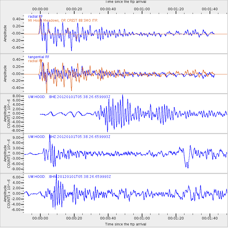
HOOD Mt Hood Meadows, OR CREST BB SMO - Earthquake Result Viewer
*The percent match for this event was below the threshold and hence no stack was calculated.
| Earthquake location: |
Southeast Of Honshu, Japan |
| Earthquake latitude/longitude: |
31.5/138.1 |
| Earthquake time(UTC): |
2012/01/01 (001) 05:27:55 GMT |
| Earthquake Depth: |
365 km |
| Earthquake Magnitude: |
6.2 MB, 6.8 MW, 6.8 MW |
| Earthquake Catalog/Contributor: |
WHDF/NEIC |
|
| Network: |
UW Pacific Northwest Regional Seismic Network |
| Station: |
HOOD Mt Hood Meadows, OR CREST BB SMO |
| Lat/Lon: |
45.32 N/121.65 W |
| Elevation: |
1520 m |
|
| Distance: |
74.9 deg |
| Az: |
45.974 deg |
| Baz: |
299.43 deg |
| Ray Param: |
$rayparam |
*The percent match for this event was below the threshold and hence was not used in the summary stack. |
|
| Radial Match: |
82.91017 % |
| Radial Bump: |
400 |
| Transverse Match: |
79.30296 % |
| Transverse Bump: |
400 |
| SOD ConfigId: |
434841 |
| Insert Time: |
2012-03-18 08:45:01.583 +0000 |
| GWidth: |
2.5 |
| Max Bumps: |
400 |
| Tol: |
0.001 |
|
Signal To Noise
| Channel | StoN | STA | LTA |
| UW:HOOD: :BHZ:20120101T05:38:26.659993Z | 6.017863 | 1.6658638E-6 | 2.7681983E-7 |
| UW:HOOD: :BHN:20120101T05:38:26.659993Z | 2.12364 | 8.640173E-7 | 4.0685677E-7 |
| UW:HOOD: :BHE:20120101T05:38:26.659993Z | 1.2266412 | 7.09708E-7 | 5.7857835E-7 |
| Arrivals |
| Ps | |
| PpPs | |
| PsPs/PpSs | |


