You are here: Home > Network List > UW - Pacific Northwest Regional Seismic Network Stations List
> Station LEBA Lebam, WA, USA > Earthquake Result Viewer
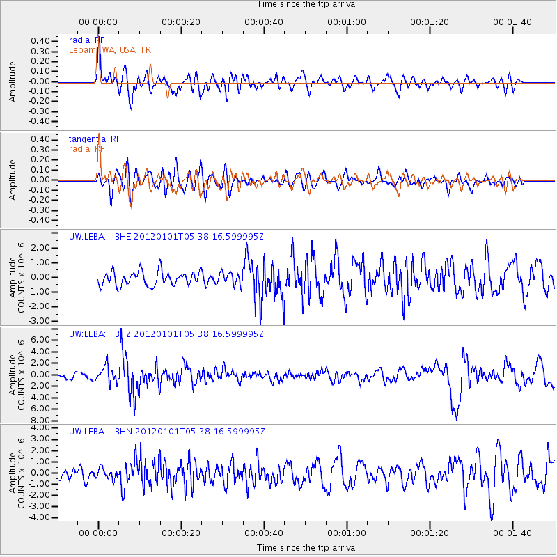
LEBA Lebam, WA, USA - Earthquake Result Viewer
*The percent match for this event was below the threshold and hence no stack was calculated.
| Earthquake location: |
Southeast Of Honshu, Japan |
| Earthquake latitude/longitude: |
31.5/138.1 |
| Earthquake time(UTC): |
2012/01/01 (001) 05:27:55 GMT |
| Earthquake Depth: |
365 km |
| Earthquake Magnitude: |
6.2 MB, 6.8 MW, 6.8 MW |
| Earthquake Catalog/Contributor: |
WHDF/NEIC |
|
| Network: |
UW Pacific Northwest Regional Seismic Network |
| Station: |
LEBA Lebam, WA, USA |
| Lat/Lon: |
46.55 N/123.56 W |
| Elevation: |
73 m |
|
| Distance: |
73.1 deg |
| Az: |
45.522 deg |
| Baz: |
297.938 deg |
| Ray Param: |
$rayparam |
*The percent match for this event was below the threshold and hence was not used in the summary stack. |
|
| Radial Match: |
70.07652 % |
| Radial Bump: |
400 |
| Transverse Match: |
59.48815 % |
| Transverse Bump: |
400 |
| SOD ConfigId: |
434841 |
| Insert Time: |
2012-03-18 08:45:57.140 +0000 |
| GWidth: |
2.5 |
| Max Bumps: |
400 |
| Tol: |
0.001 |
|
Signal To Noise
| Channel | StoN | STA | LTA |
| UW:LEBA: :BHZ:20120101T05:38:16.599995Z | 3.933559 | 1.4053619E-6 | 3.572749E-7 |
| UW:LEBA: :BHN:20120101T05:38:16.599995Z | 0.88003105 | 4.3730964E-7 | 4.969253E-7 |
| UW:LEBA: :BHE:20120101T05:38:16.599995Z | 0.8510111 | 3.991599E-7 | 4.6904194E-7 |
| Arrivals |
| Ps | |
| PpPs | |
| PsPs/PpSs | |


