You are here: Home > Network List > TA - USArray Transportable Network (new EarthScope stations) Stations List
> Station 143A Socs Landing, Pioneer, LA, USA > Earthquake Result Viewer
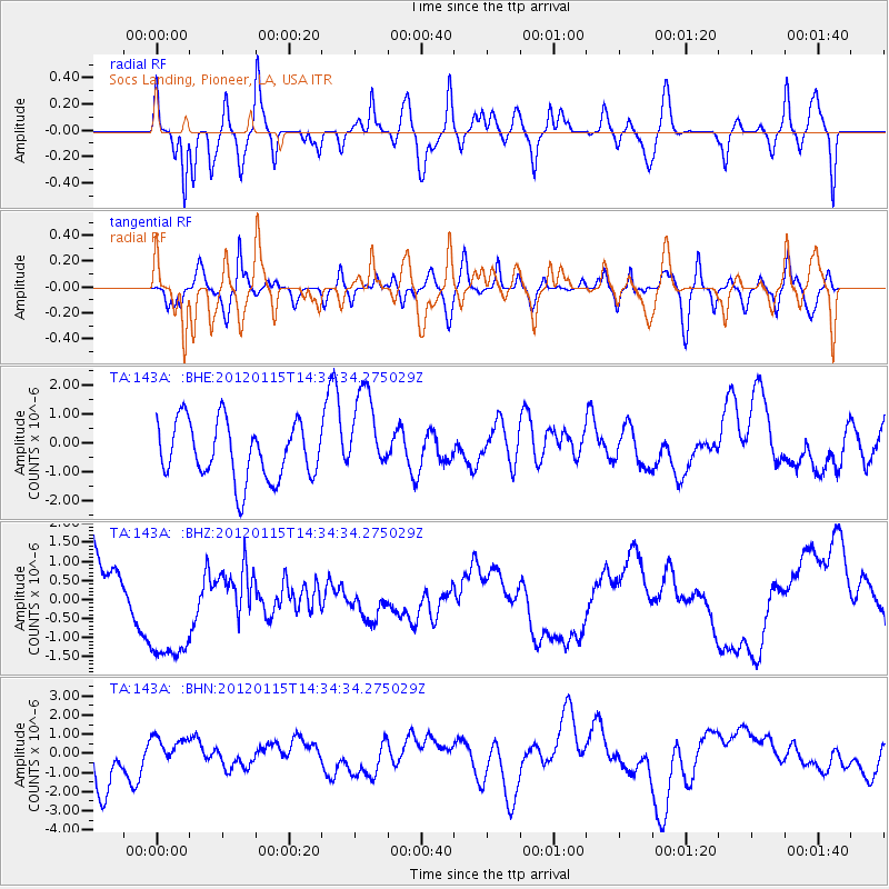
143A Socs Landing, Pioneer, LA, USA - Earthquake Result Viewer
*The percent match for this event was below the threshold and hence no stack was calculated.
| Earthquake location: |
South Shetland Islands |
| Earthquake latitude/longitude: |
-60.9/-56.0 |
| Earthquake time(UTC): |
2012/01/15 (015) 14:21:31 GMT |
| Earthquake Depth: |
10 km |
| Earthquake Magnitude: |
6.2 MB, 5.9 MS, 6.0 MW |
| Earthquake Catalog/Contributor: |
WHDF/NEIC |
|
| Network: |
TA USArray Transportable Network (new EarthScope stations) |
| Station: |
143A Socs Landing, Pioneer, LA, USA |
| Lat/Lon: |
32.70 N/91.40 W |
| Elevation: |
30 m |
|
| Distance: |
97.6 deg |
| Az: |
330.445 deg |
| Baz: |
163.373 deg |
| Ray Param: |
$rayparam |
*The percent match for this event was below the threshold and hence was not used in the summary stack. |
|
| Radial Match: |
76.04348 % |
| Radial Bump: |
400 |
| Transverse Match: |
55.4719 % |
| Transverse Bump: |
400 |
| SOD ConfigId: |
436445 |
| Insert Time: |
2012-04-05 14:46:04.893 +0000 |
| GWidth: |
2.5 |
| Max Bumps: |
400 |
| Tol: |
0.001 |
|
Signal To Noise
| Channel | StoN | STA | LTA |
| TA:143A: :BHZ:20120115T14:34:34.275029Z | 1.0275712 | 1.4210992E-6 | 1.3829691E-6 |
| TA:143A: :BHN:20120115T14:34:34.275029Z | 0.627684 | 8.565061E-7 | 1.3645499E-6 |
| TA:143A: :BHE:20120115T14:34:34.275029Z | 1.5211965 | 1.500993E-6 | 9.867186E-7 |
| Arrivals |
| Ps | |
| PpPs | |
| PsPs/PpSs | |


