You are here: Home > Network List > G - GEOSCOPE Stations List
> Station ATD Arta Cave - Arta, Republic of Djibouti > Earthquake Result Viewer
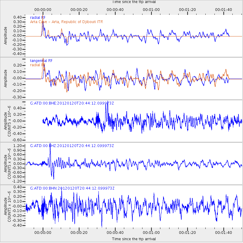
ATD Arta Cave - Arta, Republic of Djibouti - Earthquake Result Viewer
*The percent match for this event was below the threshold and hence no stack was calculated.
| Earthquake location: |
Flores Region, Indonesia |
| Earthquake latitude/longitude: |
-8.4/119.7 |
| Earthquake time(UTC): |
2012/01/20 (020) 20:32:53 GMT |
| Earthquake Depth: |
126 km |
| Earthquake Magnitude: |
5.7 MB, 5.7 MW, 5.6 MW |
| Earthquake Catalog/Contributor: |
WHDF/NEIC |
|
| Network: |
G GEOSCOPE |
| Station: |
ATD Arta Cave - Arta, Republic of Djibouti |
| Lat/Lon: |
11.53 N/42.85 E |
| Elevation: |
610 m |
|
| Distance: |
78.9 deg |
| Az: |
283.485 deg |
| Baz: |
100.985 deg |
| Ray Param: |
$rayparam |
*The percent match for this event was below the threshold and hence was not used in the summary stack. |
|
| Radial Match: |
64.50434 % |
| Radial Bump: |
400 |
| Transverse Match: |
65.36304 % |
| Transverse Bump: |
400 |
| SOD ConfigId: |
436445 |
| Insert Time: |
2012-04-05 15:15:26.510 +0000 |
| GWidth: |
2.5 |
| Max Bumps: |
400 |
| Tol: |
0.001 |
|
Signal To Noise
| Channel | StoN | STA | LTA |
| G:ATD:00:BHZ:20120120T20:44:12.099973Z | 5.2712026 | 3.859689E-7 | 7.322217E-8 |
| G:ATD:00:BHN:20120120T20:44:12.099973Z | 2.030992 | 1.16046046E-7 | 5.713762E-8 |
| G:ATD:00:BHE:20120120T20:44:12.099973Z | 2.4435902 | 1.8620392E-7 | 7.620097E-8 |
| Arrivals |
| Ps | |
| PpPs | |
| PsPs/PpSs | |


