You are here: Home > Network List > TA - USArray Transportable Network (new EarthScope stations) Stations List
> Station J01E Myrtle Point, OR, USA > Earthquake Result Viewer
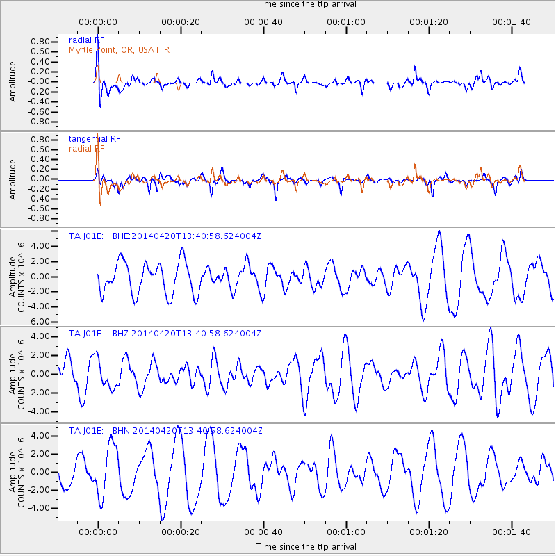
J01E Myrtle Point, OR, USA - Earthquake Result Viewer
*The percent match for this event was below the threshold and hence no stack was calculated.
| Earthquake location: |
Solomon Islands |
| Earthquake latitude/longitude: |
-6.9/154.8 |
| Earthquake time(UTC): |
2014/04/20 (110) 13:28:42 GMT |
| Earthquake Depth: |
41 km |
| Earthquake Magnitude: |
5.2 MW |
| Earthquake Catalog/Contributor: |
ISC/ISC |
|
| Network: |
TA USArray Transportable Network (new EarthScope stations) |
| Station: |
J01E Myrtle Point, OR, USA |
| Lat/Lon: |
43.16 N/123.93 W |
| Elevation: |
128 m |
|
| Distance: |
88.4 deg |
| Az: |
46.354 deg |
| Baz: |
259.07 deg |
| Ray Param: |
$rayparam |
*The percent match for this event was below the threshold and hence was not used in the summary stack. |
|
| Radial Match: |
63.1276 % |
| Radial Bump: |
400 |
| Transverse Match: |
84.091606 % |
| Transverse Bump: |
400 |
| SOD ConfigId: |
3390531 |
| Insert Time: |
2019-04-11 13:26:43.849 +0000 |
| GWidth: |
2.5 |
| Max Bumps: |
400 |
| Tol: |
0.001 |
|
Signal To Noise
| Channel | StoN | STA | LTA |
| TA:J01E: :BHZ:20140420T13:40:58.624004Z | 0.6548726 | 1.5113482E-6 | 2.3078505E-6 |
| TA:J01E: :BHN:20140420T13:40:58.624004Z | 2.4313898 | 2.9123848E-6 | 1.1978271E-6 |
| TA:J01E: :BHE:20140420T13:40:58.624004Z | 0.5813087 | 1.209901E-6 | 2.08134E-6 |
| Arrivals |
| Ps | |
| PpPs | |
| PsPs/PpSs | |


