CPUP Villa Florida, Paraguay - Earthquake Result Viewer
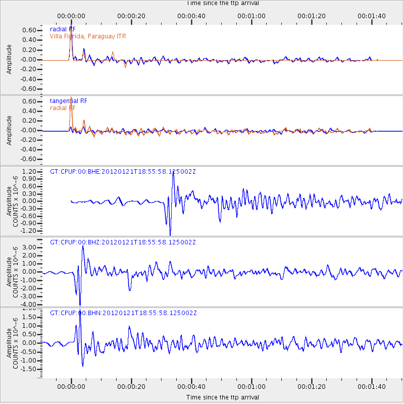
Earthquake location: Near Coast Of Chiapas, Mexico
Earthquake latitude/longitude: 14.9/-93.0
Earthquake time(UTC): 2012/01/21 (021) 18:47:11 GMT
Earthquake Depth: 45 km
Earthquake Magnitude: 5.9 MB, 5.8 MS, 6.2 MW, 6.3 MW
Earthquake Catalog/Contributor: WHDF/NEIC
Network: GT Global Telemetered Seismograph Network (USAF/USGS)
Station: CPUP Villa Florida, Paraguay
Lat/Lon: 26.33 S/57.33 W
Elevation: 105 m
Distance: 53.7 deg
Az: 139.488 deg
Baz: 315.581 deg
Ray Param: 0.065835394
Estimated Moho Depth: 25.25 km
Estimated Crust Vp/Vs: 2.05
Assumed Crust Vp: 6.498 km/s
Estimated Crust Vs: 3.173 km/s
Estimated Crust Poisson's Ratio: 0.34
Radial Match: 94.09149 %
Radial Bump: 324
Transverse Match: 78.62178 %
Transverse Bump: 400
SOD ConfigId: 436445
Insert Time: 2012-04-05 15:21:04.953 +0000
GWidth: 2.5
Max Bumps: 400
Tol: 0.001

Signal To Noise

ChannelStoNSTALTA
GT:CPUP:00:BHZ:20120121T18:55:58.125002Z18.400861.6975195E-69.2252186E-8
GT:CPUP:00:BHN:20120121T18:55:58.125002Z12.2750187.263663E-75.9174358E-8
GT:CPUP:00:BHE:20120121T18:55:58.125002Z10.1024275.910601E-75.8506746E-8
Arrivals
Ps4.3 SECOND
PpPs11 SECOND
PsPs/PpSs16 SECOND