You are here: Home > Network List > TA - USArray Transportable Network (new EarthScope stations) Stations List
> Station J05D Fort Rock, OR, USA > Earthquake Result Viewer
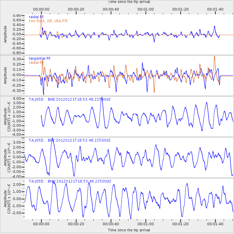
J05D Fort Rock, OR, USA - Earthquake Result Viewer
*The percent match for this event was below the threshold and hence no stack was calculated.
| Earthquake location: |
Near Coast Of Chiapas, Mexico |
| Earthquake latitude/longitude: |
14.9/-93.0 |
| Earthquake time(UTC): |
2012/01/21 (021) 18:47:11 GMT |
| Earthquake Depth: |
45 km |
| Earthquake Magnitude: |
5.9 MB, 5.8 MS, 6.2 MW, 6.3 MW |
| Earthquake Catalog/Contributor: |
WHDF/NEIC |
|
| Network: |
TA USArray Transportable Network (new EarthScope stations) |
| Station: |
J05D Fort Rock, OR, USA |
| Lat/Lon: |
43.28 N/121.23 W |
| Elevation: |
1541 m |
|
| Distance: |
37.2 deg |
| Az: |
325.172 deg |
| Baz: |
130.869 deg |
| Ray Param: |
$rayparam |
*The percent match for this event was below the threshold and hence was not used in the summary stack. |
|
| Radial Match: |
58.56811 % |
| Radial Bump: |
382 |
| Transverse Match: |
65.065346 % |
| Transverse Bump: |
400 |
| SOD ConfigId: |
436445 |
| Insert Time: |
2012-04-05 15:24:30.748 +0000 |
| GWidth: |
2.5 |
| Max Bumps: |
400 |
| Tol: |
0.001 |
|
Signal To Noise
| Channel | StoN | STA | LTA |
| TA:J05D: :BHZ:20120121T18:53:48.225009Z | 3.06434 | 1.9775814E-6 | 6.453531E-7 |
| TA:J05D: :BHN:20120121T18:53:48.225009Z | 0.9470734 | 9.0554374E-7 | 9.561495E-7 |
| TA:J05D: :BHE:20120121T18:53:48.225009Z | 1.9128302 | 2.0672421E-6 | 1.0807242E-6 |
| Arrivals |
| Ps | |
| PpPs | |
| PsPs/PpSs | |


