E34A Wadena, MN, USA - Earthquake Result Viewer
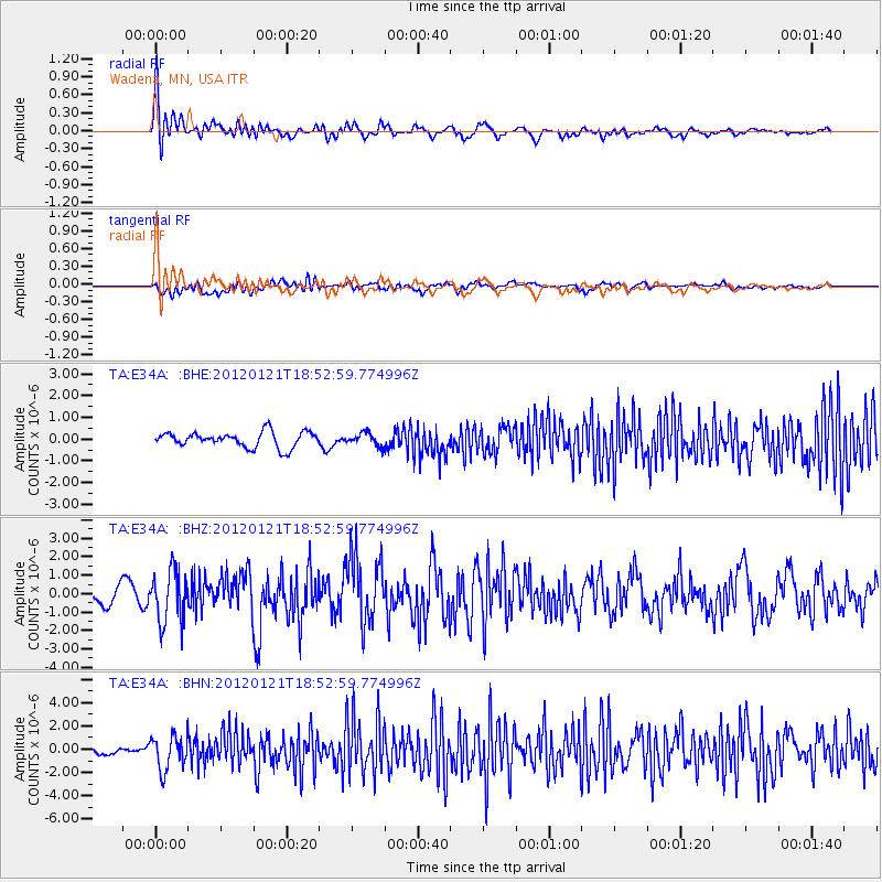
Earthquake location: Near Coast Of Chiapas, Mexico
Earthquake latitude/longitude: 14.9/-93.0
Earthquake time(UTC): 2012/01/21 (021) 18:47:11 GMT
Earthquake Depth: 45 km
Earthquake Magnitude: 5.9 MB, 5.8 MS, 6.2 MW, 6.3 MW
Earthquake Catalog/Contributor: WHDF/NEIC
Network: TA USArray Transportable Network (new EarthScope stations)
Station: E34A Wadena, MN, USA
Lat/Lon: 46.51 N/95.17 W
Elevation: 430 m
Distance: 31.6 deg
Az: 357.147 deg
Baz: 176.004 deg
Ray Param: 0.078923546
Estimated Moho Depth: 23.25 km
Estimated Crust Vp/Vs: 1.74
Assumed Crust Vp: 6.419 km/s
Estimated Crust Vs: 3.695 km/s
Estimated Crust Poisson's Ratio: 0.25
Radial Match: 85.89818 %
Radial Bump: 400
Transverse Match: 75.5916 %
Transverse Bump: 400
SOD ConfigId: 436445
Insert Time: 2012-04-05 15:25:53.143 +0000
GWidth: 2.5
Max Bumps: 400
Tol: 0.001

Signal To Noise

ChannelStoNSTALTA
TA:E34A: :BHZ:20120121T18:52:59.774996Z2.84161641.3993586E-64.924516E-7
TA:E34A: :BHN:20120121T18:52:59.774996Z4.95693831.4388971E-62.9027942E-7
TA:E34A: :BHE:20120121T18:52:59.774996Z0.839513662.9923768E-73.5644172E-7
Arrivals
Ps2.9 SECOND
PpPs9.1 SECOND
PsPs/PpSs12 SECOND