G32A Webster, SD, USA - Earthquake Result Viewer
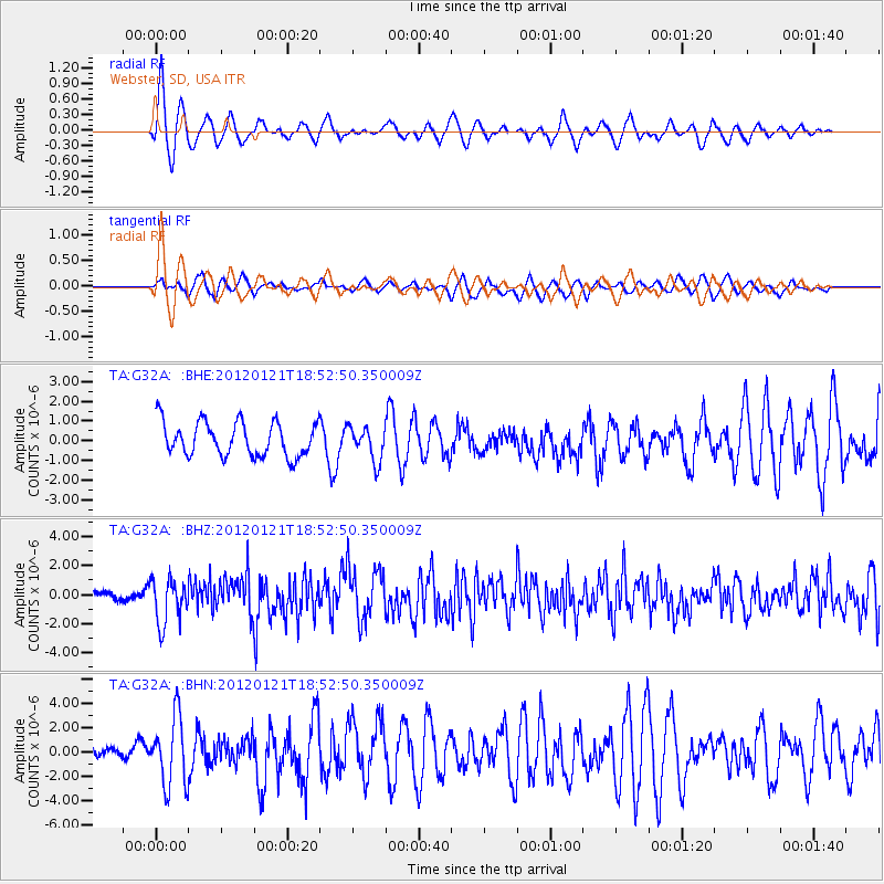
Earthquake location: Near Coast Of Chiapas, Mexico
Earthquake latitude/longitude: 14.9/-93.0
Earthquake time(UTC): 2012/01/21 (021) 18:47:11 GMT
Earthquake Depth: 45 km
Earthquake Magnitude: 5.9 MB, 5.8 MS, 6.2 MW, 6.3 MW
Earthquake Catalog/Contributor: WHDF/NEIC
Network: TA USArray Transportable Network (new EarthScope stations)
Station: G32A Webster, SD, USA
Lat/Lon: 45.26 N/97.50 W
Elevation: 566 m
Distance: 30.5 deg
Az: 353.744 deg
Baz: 171.42 deg
Ray Param: 0.07925604
Estimated Moho Depth: 11.5 km
Estimated Crust Vp/Vs: 1.60
Assumed Crust Vp: 6.552 km/s
Estimated Crust Vs: 4.095 km/s
Estimated Crust Poisson's Ratio: 0.18
Radial Match: 83.897354 %
Radial Bump: 400
Transverse Match: 59.163643 %
Transverse Bump: 400
SOD ConfigId: 436445
Insert Time: 2012-04-05 15:26:19.714 +0000
GWidth: 2.5
Max Bumps: 400
Tol: 0.001

Signal To Noise

ChannelStoNSTALTA
TA:G32A: :BHZ:20120121T18:52:50.350009Z5.5814831.5357882E-62.7515773E-7
TA:G32A: :BHN:20120121T18:52:50.350009Z4.6338532.7900762E-66.021072E-7
TA:G32A: :BHE:20120121T18:52:50.350009Z0.98176478.5219017E-78.680188E-7
Arrivals
Ps1.2 SECOND
PpPs4.2 SECOND
PsPs/PpSs5.3 SECOND