You are here: Home > Network List > TA - USArray Transportable Network (new EarthScope stations) Stations List
> Station E37A Wrenshall, MN, USA > Earthquake Result Viewer
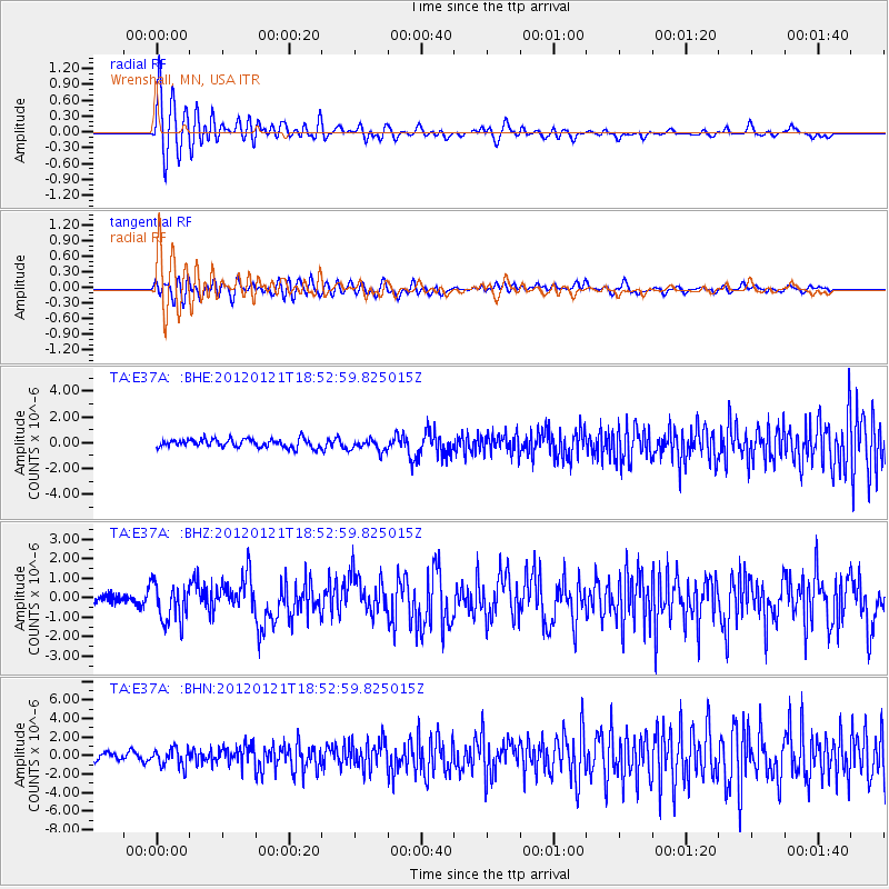
E37A Wrenshall, MN, USA - Earthquake Result Viewer
*The percent match for this event was below the threshold and hence no stack was calculated.
| Earthquake location: |
Near Coast Of Chiapas, Mexico |
| Earthquake latitude/longitude: |
14.9/-93.0 |
| Earthquake time(UTC): |
2012/01/21 (021) 18:47:11 GMT |
| Earthquake Depth: |
45 km |
| Earthquake Magnitude: |
5.9 MB, 5.8 MS, 6.2 MW, 6.3 MW |
| Earthquake Catalog/Contributor: |
WHDF/NEIC |
|
| Network: |
TA USArray Transportable Network (new EarthScope stations) |
| Station: |
E37A Wrenshall, MN, USA |
| Lat/Lon: |
46.57 N/92.40 W |
| Elevation: |
304 m |
|
| Distance: |
31.6 deg |
| Az: |
0.797 deg |
| Baz: |
181.116 deg |
| Ray Param: |
$rayparam |
*The percent match for this event was below the threshold and hence was not used in the summary stack. |
|
| Radial Match: |
77.27021 % |
| Radial Bump: |
400 |
| Transverse Match: |
55.118187 % |
| Transverse Bump: |
400 |
| SOD ConfigId: |
436445 |
| Insert Time: |
2012-04-05 15:27:09.505 +0000 |
| GWidth: |
2.5 |
| Max Bumps: |
400 |
| Tol: |
0.001 |
|
Signal To Noise
| Channel | StoN | STA | LTA |
| TA:E37A: :BHZ:20120121T18:52:59.825015Z | 3.7984965 | 9.897976E-7 | 2.6057614E-7 |
| TA:E37A: :BHN:20120121T18:52:59.825015Z | 1.9493887 | 9.636237E-7 | 4.9432094E-7 |
| TA:E37A: :BHE:20120121T18:52:59.825015Z | 1.436867 | 4.6240908E-7 | 3.218176E-7 |
| Arrivals |
| Ps | |
| PpPs | |
| PsPs/PpSs | |


