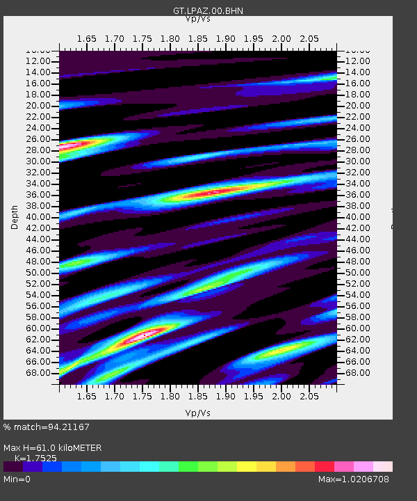
LPAZ La Paz , Bolivia - Earthquake Result Viewer
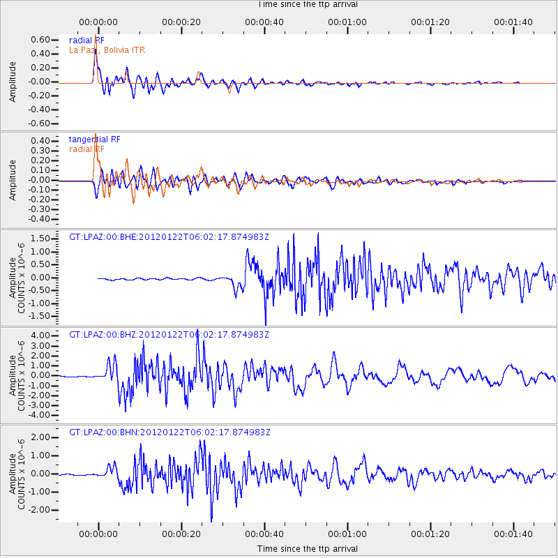
Earthquake location: South Sandwich Islands Region
Earthquake latitude/longitude: -56.8/-25.1
Earthquake time(UTC): 2012/01/22 (022) 05:53:42 GMT
Earthquake Depth: 13 km
Earthquake Magnitude: 5.5 MB, 6.1 MS, 6.0 MW, 6.0 MW
Earthquake Catalog/Contributor: WHDF/NEIC
Network: GT Global Telemetered Seismograph Network (USAF/USGS)
Station: LPAZ La Paz , Bolivia
Lat/Lon: 16.17 S/68.08 W
Elevation: 4817 m
Distance: 51.8 deg
Az: 303.596 deg
Baz: 151.485 deg
Ray Param: 0.067174
Estimated Moho Depth: 61.0 km
Estimated Crust Vp/Vs: 1.75
Assumed Crust Vp: 6.454 km/s
Estimated Crust Vs: 3.683 km/s
Estimated Crust Poisson's Ratio: 0.26
Radial Match: 94.21167 %
Radial Bump: 400
Transverse Match: 84.49651 %
Transverse Bump: 400
SOD ConfigId: 436445
Insert Time: 2012-04-05 15:33:21.989 +0000
GWidth: 2.5
Max Bumps: 400
Tol: 0.001

Signal To Noise

ChannelStoNSTALTA
GT:LPAZ:00:BHZ:20120122T06:02:17.874983Z22.8603129.02958E-73.949894E-8
GT:LPAZ:00:BHN:20120122T06:02:17.874983Z6.33325623.1624506E-74.993404E-8
GT:LPAZ:00:BHE:20120122T06:02:17.874983Z9.5119712.8713606E-73.0186808E-8
Arrivals
Ps7.5 SECOND
PpPs25 SECOND
PsPs/PpSs32 SECOND