You are here: Home > Network List > TA - USArray Transportable Network (new EarthScope stations) Stations List
> Station J04D Umpqua National Forest, Toketee, OR, USA > Earthquake Result Viewer
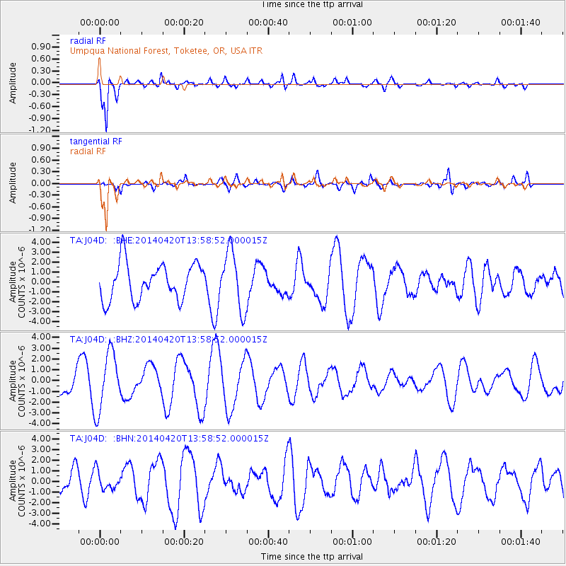
J04D Umpqua National Forest, Toketee, OR, USA - Earthquake Result Viewer
*The percent match for this event was below the threshold and hence no stack was calculated.
| Earthquake location: |
Off East Coast Of Kamchatka |
| Earthquake latitude/longitude: |
53.1/163.1 |
| Earthquake time(UTC): |
2014/04/20 (110) 13:50:41 GMT |
| Earthquake Depth: |
36 km |
| Earthquake Magnitude: |
5.2 MW |
| Earthquake Catalog/Contributor: |
ISC/ISC |
|
| Network: |
TA USArray Transportable Network (new EarthScope stations) |
| Station: |
J04D Umpqua National Forest, Toketee, OR, USA |
| Lat/Lon: |
43.24 N/122.11 W |
| Elevation: |
1948 m |
|
| Distance: |
48.7 deg |
| Az: |
69.841 deg |
| Baz: |
309.263 deg |
| Ray Param: |
$rayparam |
*The percent match for this event was below the threshold and hence was not used in the summary stack. |
|
| Radial Match: |
84.37979 % |
| Radial Bump: |
400 |
| Transverse Match: |
50.395164 % |
| Transverse Bump: |
400 |
| SOD ConfigId: |
3390531 |
| Insert Time: |
2019-04-11 13:33:45.560 +0000 |
| GWidth: |
2.5 |
| Max Bumps: |
400 |
| Tol: |
0.001 |
|
Signal To Noise
| Channel | StoN | STA | LTA |
| TA:J04D: :BHZ:20140420T13:58:52.000015Z | 2.144479 | 2.6543325E-6 | 1.2377517E-6 |
| TA:J04D: :BHN:20140420T13:58:52.000015Z | 0.60350466 | 8.122757E-7 | 1.3459311E-6 |
| TA:J04D: :BHE:20140420T13:58:52.000015Z | 1.6773993 | 3.06776E-6 | 1.8288787E-6 |
| Arrivals |
| Ps | |
| PpPs | |
| PsPs/PpSs | |


