You are here: Home > Network List > TA - USArray Transportable Network (new EarthScope stations) Stations List
> Station W56A Indian Trail, NC, USA > Earthquake Result Viewer
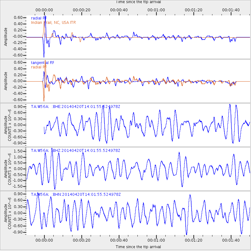
W56A Indian Trail, NC, USA - Earthquake Result Viewer
*The percent match for this event was below the threshold and hence no stack was calculated.
| Earthquake location: |
Off East Coast Of Kamchatka |
| Earthquake latitude/longitude: |
53.1/163.1 |
| Earthquake time(UTC): |
2014/04/20 (110) 13:50:41 GMT |
| Earthquake Depth: |
36 km |
| Earthquake Magnitude: |
5.2 MW |
| Earthquake Catalog/Contributor: |
ISC/ISC |
|
| Network: |
TA USArray Transportable Network (new EarthScope stations) |
| Station: |
W56A Indian Trail, NC, USA |
| Lat/Lon: |
35.13 N/80.58 W |
| Elevation: |
177 m |
|
| Distance: |
76.2 deg |
| Az: |
49.115 deg |
| Baz: |
326.222 deg |
| Ray Param: |
$rayparam |
*The percent match for this event was below the threshold and hence was not used in the summary stack. |
|
| Radial Match: |
79.82911 % |
| Radial Bump: |
400 |
| Transverse Match: |
53.048378 % |
| Transverse Bump: |
400 |
| SOD ConfigId: |
3390531 |
| Insert Time: |
2019-04-11 13:34:24.558 +0000 |
| GWidth: |
2.5 |
| Max Bumps: |
400 |
| Tol: |
0.001 |
|
Signal To Noise
| Channel | StoN | STA | LTA |
| TA:W56A: :BHZ:20140420T14:01:55.524978Z | 2.8881726 | 1.0046233E-6 | 3.4784048E-7 |
| TA:W56A: :BHN:20140420T14:01:55.524978Z | 1.1811749 | 4.367358E-7 | 3.6974694E-7 |
| TA:W56A: :BHE:20140420T14:01:55.524978Z | 2.3022518 | 6.326002E-7 | 2.7477452E-7 |
| Arrivals |
| Ps | |
| PpPs | |
| PsPs/PpSs | |


