You are here: Home > Network List > TA - USArray Transportable Network (new EarthScope stations) Stations List
> Station O33A Hebron, NE, USA > Earthquake Result Viewer
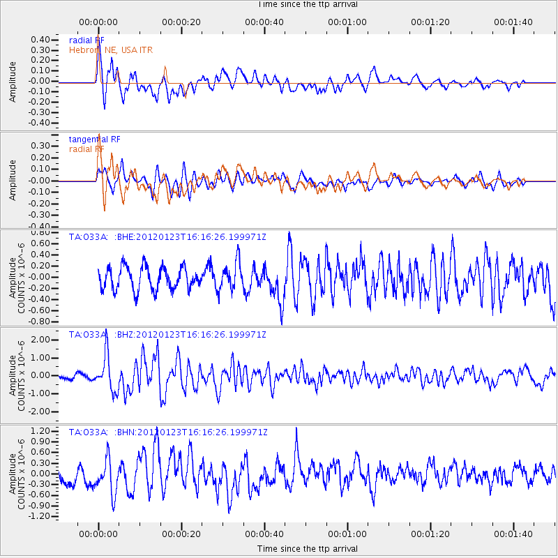
O33A Hebron, NE, USA - Earthquake Result Viewer
*The percent match for this event was below the threshold and hence no stack was calculated.
| Earthquake location: |
Near Coast Of Central Chile |
| Earthquake latitude/longitude: |
-36.4/-73.0 |
| Earthquake time(UTC): |
2012/01/23 (023) 16:04:52 GMT |
| Earthquake Depth: |
20 km |
| Earthquake Magnitude: |
5.8 MB, 6.0 MS, 6.1 MW, 6.2 MW |
| Earthquake Catalog/Contributor: |
WHDF/NEIC |
|
| Network: |
TA USArray Transportable Network (new EarthScope stations) |
| Station: |
O33A Hebron, NE, USA |
| Lat/Lon: |
40.08 N/97.58 W |
| Elevation: |
480 m |
|
| Distance: |
79.4 deg |
| Az: |
341.07 deg |
| Baz: |
160.059 deg |
| Ray Param: |
$rayparam |
*The percent match for this event was below the threshold and hence was not used in the summary stack. |
|
| Radial Match: |
72.19169 % |
| Radial Bump: |
400 |
| Transverse Match: |
73.26824 % |
| Transverse Bump: |
400 |
| SOD ConfigId: |
436445 |
| Insert Time: |
2012-04-05 15:56:06.701 +0000 |
| GWidth: |
2.5 |
| Max Bumps: |
400 |
| Tol: |
0.001 |
|
Signal To Noise
| Channel | StoN | STA | LTA |
| TA:O33A: :BHZ:20120123T16:16:26.199971Z | 7.1701345 | 1.0228822E-6 | 1.4265872E-7 |
| TA:O33A: :BHN:20120123T16:16:26.199971Z | 2.270845 | 5.030826E-7 | 2.2153984E-7 |
| TA:O33A: :BHE:20120123T16:16:26.199971Z | 1.2273988 | 2.46996E-7 | 2.0123531E-7 |
| Arrivals |
| Ps | |
| PpPs | |
| PsPs/PpSs | |


