You are here: Home > Network List > TA - USArray Transportable Network (new EarthScope stations) Stations List
> Station G31A Conde, SD, USA > Earthquake Result Viewer
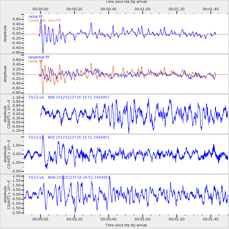
G31A Conde, SD, USA - Earthquake Result Viewer
*The percent match for this event was below the threshold and hence no stack was calculated.
| Earthquake location: |
Near Coast Of Central Chile |
| Earthquake latitude/longitude: |
-36.4/-73.0 |
| Earthquake time(UTC): |
2012/01/23 (023) 16:04:52 GMT |
| Earthquake Depth: |
20 km |
| Earthquake Magnitude: |
5.8 MB, 6.0 MS, 6.1 MW, 6.2 MW |
| Earthquake Catalog/Contributor: |
WHDF/NEIC |
|
| Network: |
TA USArray Transportable Network (new EarthScope stations) |
| Station: |
G31A Conde, SD, USA |
| Lat/Lon: |
45.23 N/98.21 W |
| Elevation: |
393 m |
|
| Distance: |
84.4 deg |
| Az: |
342.416 deg |
| Baz: |
159.827 deg |
| Ray Param: |
$rayparam |
*The percent match for this event was below the threshold and hence was not used in the summary stack. |
|
| Radial Match: |
82.047356 % |
| Radial Bump: |
400 |
| Transverse Match: |
63.747902 % |
| Transverse Bump: |
400 |
| SOD ConfigId: |
436445 |
| Insert Time: |
2012-04-05 16:02:19.365 +0000 |
| GWidth: |
2.5 |
| Max Bumps: |
400 |
| Tol: |
0.001 |
|
Signal To Noise
| Channel | StoN | STA | LTA |
| TA:G31A: :BHZ:20120123T16:16:52.349995Z | 4.707702 | 1.0167869E-6 | 2.1598368E-7 |
| TA:G31A: :BHN:20120123T16:16:52.349995Z | 2.5204883 | 7.5612627E-7 | 2.9999197E-7 |
| TA:G31A: :BHE:20120123T16:16:52.349995Z | 1.1871235 | 3.3434503E-7 | 2.81643E-7 |
| Arrivals |
| Ps | |
| PpPs | |
| PsPs/PpSs | |


