You are here: Home > Network List > UW - Pacific Northwest Regional Seismic Network Stations List
> Station PASS Maple Falls, WA, USA > Earthquake Result Viewer
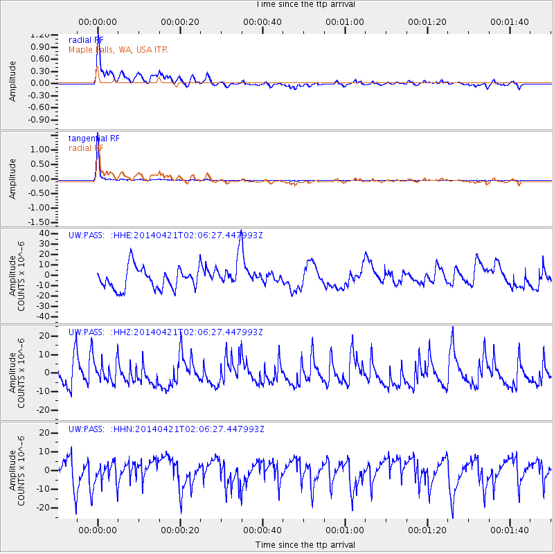
PASS Maple Falls, WA, USA - Earthquake Result Viewer
*The percent match for this event was below the threshold and hence no stack was calculated.
| Earthquake location: |
Solomon Islands |
| Earthquake latitude/longitude: |
-6.8/154.7 |
| Earthquake time(UTC): |
2014/04/21 (111) 01:54:00 GMT |
| Earthquake Depth: |
39 km |
| Earthquake Magnitude: |
5.1 MW |
| Earthquake Catalog/Contributor: |
ISC/ISC |
|
| Network: |
UW Pacific Northwest Regional Seismic Network |
| Station: |
PASS Maple Falls, WA, USA |
| Lat/Lon: |
49.00 N/122.09 W |
| Elevation: |
174 m |
|
| Distance: |
90.6 deg |
| Az: |
40.848 deg |
| Baz: |
260.507 deg |
| Ray Param: |
$rayparam |
*The percent match for this event was below the threshold and hence was not used in the summary stack. |
|
| Radial Match: |
81.1637 % |
| Radial Bump: |
400 |
| Transverse Match: |
99.07103 % |
| Transverse Bump: |
118 |
| SOD ConfigId: |
3390531 |
| Insert Time: |
2019-04-11 13:40:50.128 +0000 |
| GWidth: |
2.5 |
| Max Bumps: |
400 |
| Tol: |
0.001 |
|
Signal To Noise
| Channel | StoN | STA | LTA |
| UW:PASS: :HHZ:20140421T02:06:27.447993Z | 0.6061596 | 5.3119115E-6 | 8.763222E-6 |
| UW:PASS: :HHN:20140421T02:06:27.447993Z | 0.61393297 | 5.2226947E-6 | 8.506946E-6 |
| UW:PASS: :HHE:20140421T02:06:27.447993Z | 1.5790898 | 1.590755E-5 | 1.00738725E-5 |
| Arrivals |
| Ps | |
| PpPs | |
| PsPs/PpSs | |


