You are here: Home > Network List > G - GEOSCOPE Stations List
> Station HYB Hyderabad, India > Earthquake Result Viewer
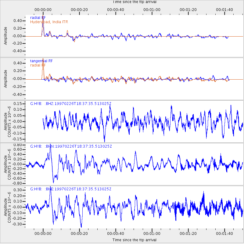
HYB Hyderabad, India - Earthquake Result Viewer
*The percent match for this event was below the threshold and hence no stack was calculated.
| Earthquake location: |
Southeast Indian Ridge |
| Earthquake latitude/longitude: |
-47.5/100.3 |
| Earthquake time(UTC): |
1997/02/26 (057) 18:27:10 GMT |
| Earthquake Depth: |
10 km |
| Earthquake Magnitude: |
6.0 MS, 5.2 MB, 6.0 UNKNOWN, 6.0 MW |
| Earthquake Catalog/Contributor: |
WHDF/NEIC |
|
| Network: |
G GEOSCOPE |
| Station: |
HYB Hyderabad, India |
| Lat/Lon: |
17.42 N/78.55 E |
| Elevation: |
510 m |
|
| Distance: |
67.5 deg |
| Az: |
337.506 deg |
| Baz: |
164.233 deg |
| Ray Param: |
$rayparam |
*The percent match for this event was below the threshold and hence was not used in the summary stack. |
|
| Radial Match: |
74.59536 % |
| Radial Bump: |
400 |
| Transverse Match: |
61.02504 % |
| Transverse Bump: |
400 |
| SOD ConfigId: |
4480 |
| Insert Time: |
2010-02-26 23:03:34.378 +0000 |
| GWidth: |
2.5 |
| Max Bumps: |
400 |
| Tol: |
0.001 |
|
Signal To Noise
| Channel | StoN | STA | LTA |
| G:HYB: :BHN:19970226T18:37:35.513025Z | 4.2957053 | 3.288657E-7 | 7.655685E-8 |
| G:HYB: :BHE:19970226T18:37:35.513025Z | 2.3644867 | 1.3762784E-7 | 5.820622E-8 |
| G:HYB: :BHZ:19970226T18:37:35.513025Z | 1.6898106 | 6.773995E-8 | 4.00873E-8 |
| Arrivals |
| Ps | |
| PpPs | |
| PsPs/PpSs | |


