You are here: Home > Network List > BK - Berkeley Digital Seismograph Network Stations List
> Station HUMO Hull Mountain, OR > Earthquake Result Viewer
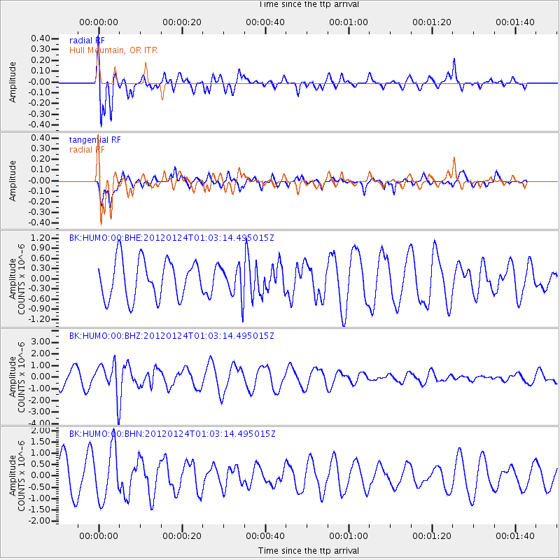
HUMO Hull Mountain, OR - Earthquake Result Viewer
*The percent match for this event was below the threshold and hence no stack was calculated.
| Earthquake location: |
South Of Fiji Islands |
| Earthquake latitude/longitude: |
-25.0/178.5 |
| Earthquake time(UTC): |
2012/01/24 (024) 00:52:05 GMT |
| Earthquake Depth: |
580 km |
| Earthquake Magnitude: |
5.8 MB, 6.3 MW, 6.4 MW |
| Earthquake Catalog/Contributor: |
WHDF/NEIC |
|
| Network: |
BK Berkeley Digital Seismograph Network |
| Station: |
HUMO Hull Mountain, OR |
| Lat/Lon: |
42.61 N/122.96 W |
| Elevation: |
555 m |
|
| Distance: |
86.2 deg |
| Az: |
39.127 deg |
| Baz: |
230.872 deg |
| Ray Param: |
$rayparam |
*The percent match for this event was below the threshold and hence was not used in the summary stack. |
|
| Radial Match: |
56.37753 % |
| Radial Bump: |
362 |
| Transverse Match: |
53.847553 % |
| Transverse Bump: |
312 |
| SOD ConfigId: |
436445 |
| Insert Time: |
2012-04-05 16:37:57.011 +0000 |
| GWidth: |
2.5 |
| Max Bumps: |
400 |
| Tol: |
0.001 |
|
Signal To Noise
| Channel | StoN | STA | LTA |
| BK:HUMO:00:BHZ:20120124T01:03:14.495015Z | 1.6622438 | 1.3799273E-6 | 8.3015937E-7 |
| BK:HUMO:00:BHN:20120124T01:03:14.495015Z | 1.6257455 | 1.1359713E-6 | 6.987387E-7 |
| BK:HUMO:00:BHE:20120124T01:03:14.495015Z | 0.8024433 | 4.5340374E-7 | 5.6502904E-7 |
| Arrivals |
| Ps | |
| PpPs | |
| PsPs/PpSs | |


