You are here: Home > Network List > CI - Caltech Regional Seismic Network Stations List
> Station SMM Simmler, CA, USA > Earthquake Result Viewer
SMM Simmler, CA, USA - Earthquake Result Viewer
*The percent match for this event was below the threshold and hence no stack was calculated.
| Earthquake location: |
South Of Fiji Islands |
| Earthquake latitude/longitude: |
-25.0/178.5 |
| Earthquake time(UTC): |
2012/01/24 (024) 00:52:05 GMT |
| Earthquake Depth: |
580 km |
| Earthquake Magnitude: |
5.8 MB, 6.3 MW, 6.4 MW |
| Earthquake Catalog/Contributor: |
WHDF/NEIC |
|
| Network: |
CI Caltech Regional Seismic Network |
| Station: |
SMM Simmler, CA, USA |
| Lat/Lon: |
35.31 N/120.00 W |
| Elevation: |
599 m |
|
| Distance: |
83.5 deg |
| Az: |
46.32 deg |
| Baz: |
233.376 deg |
| Ray Param: |
$rayparam |
*The percent match for this event was below the threshold and hence was not used in the summary stack. |
|
| Radial Match: |
55.36513 % |
| Radial Bump: |
400 |
| Transverse Match: |
54.851597 % |
| Transverse Bump: |
400 |
| SOD ConfigId: |
436445 |
| Insert Time: |
2012-04-05 16:40:25.802 +0000 |
| GWidth: |
2.5 |
| Max Bumps: |
400 |
| Tol: |
0.001 |
|
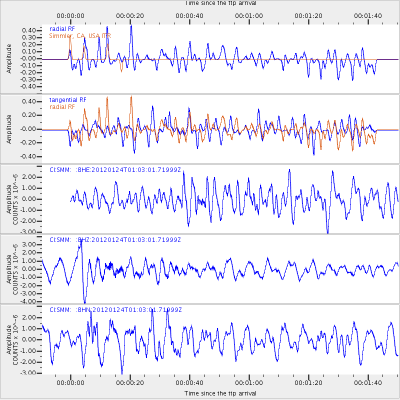
Signal To Noise
| Channel | StoN | STA | LTA |
| CI:SMM: :BHZ:20120124T01:03:01.71999Z | 3.4195032 | 2.1365877E-6 | 6.2482405E-7 |
| CI:SMM: :BHN:20120124T01:03:01.71999Z | 0.87219834 | 8.839893E-7 | 1.0135186E-6 |
| CI:SMM: :BHE:20120124T01:03:01.71999Z | 0.9261639 | 5.593556E-7 | 6.039488E-7 |
| Arrivals |
| Ps | |
| PpPs | |
| PsPs/PpSs | |


