You are here: Home > Network List > CI - Caltech Regional Seismic Network Stations List
> Station TUQ Turquiose Mountain, Baker, CA, USA > Earthquake Result Viewer
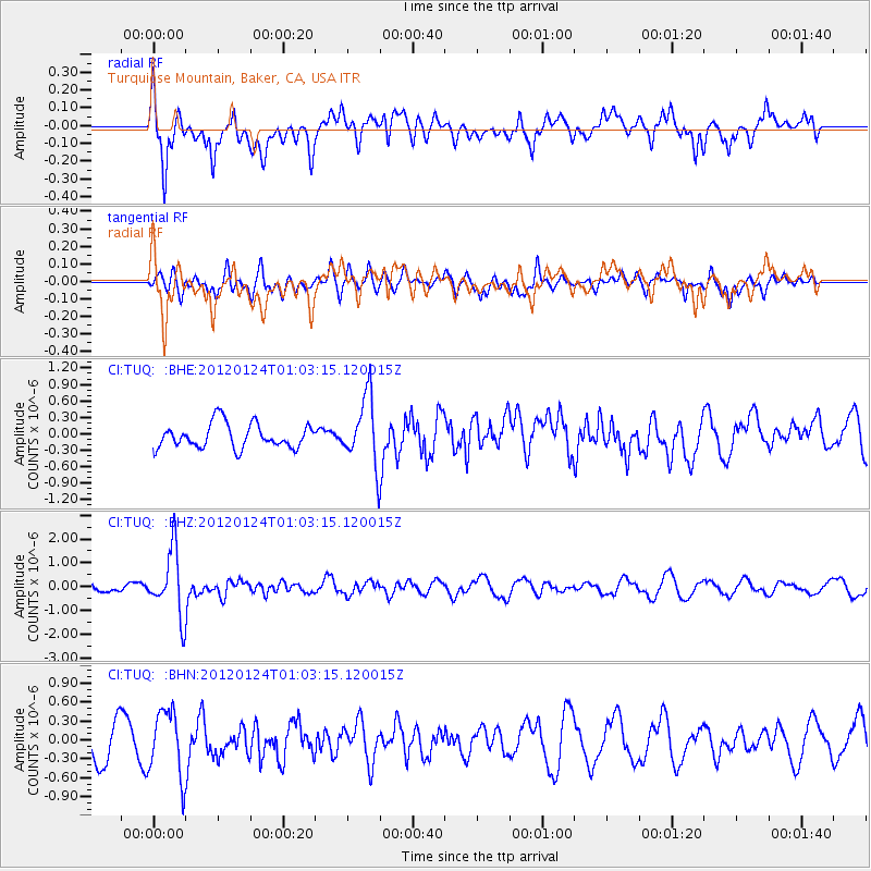
TUQ Turquiose Mountain, Baker, CA, USA - Earthquake Result Viewer
*The percent match for this event was below the threshold and hence no stack was calculated.
| Earthquake location: |
South Of Fiji Islands |
| Earthquake latitude/longitude: |
-25.0/178.5 |
| Earthquake time(UTC): |
2012/01/24 (024) 00:52:05 GMT |
| Earthquake Depth: |
580 km |
| Earthquake Magnitude: |
5.8 MB, 6.3 MW, 6.4 MW |
| Earthquake Catalog/Contributor: |
WHDF/NEIC |
|
| Network: |
CI Caltech Regional Seismic Network |
| Station: |
TUQ Turquiose Mountain, Baker, CA, USA |
| Lat/Lon: |
35.44 N/115.92 W |
| Elevation: |
1350 m |
|
| Distance: |
86.3 deg |
| Az: |
48.154 deg |
| Baz: |
235.886 deg |
| Ray Param: |
$rayparam |
*The percent match for this event was below the threshold and hence was not used in the summary stack. |
|
| Radial Match: |
73.020035 % |
| Radial Bump: |
400 |
| Transverse Match: |
38.16442 % |
| Transverse Bump: |
375 |
| SOD ConfigId: |
436445 |
| Insert Time: |
2012-04-05 16:41:48.726 +0000 |
| GWidth: |
2.5 |
| Max Bumps: |
400 |
| Tol: |
0.001 |
|
Signal To Noise
| Channel | StoN | STA | LTA |
| CI:TUQ: :BHZ:20120124T01:03:15.120015Z | 8.426881 | 1.374695E-6 | 1.6313213E-7 |
| CI:TUQ: :BHN:20120124T01:03:15.120015Z | 2.3002822 | 5.217385E-7 | 2.26815E-7 |
| CI:TUQ: :BHE:20120124T01:03:15.120015Z | 2.8067982 | 6.192846E-7 | 2.2063738E-7 |
| Arrivals |
| Ps | |
| PpPs | |
| PsPs/PpSs | |


