You are here: Home > Network List > CI - Caltech Regional Seismic Network Stations List
> Station MUR Murrieta > Earthquake Result Viewer
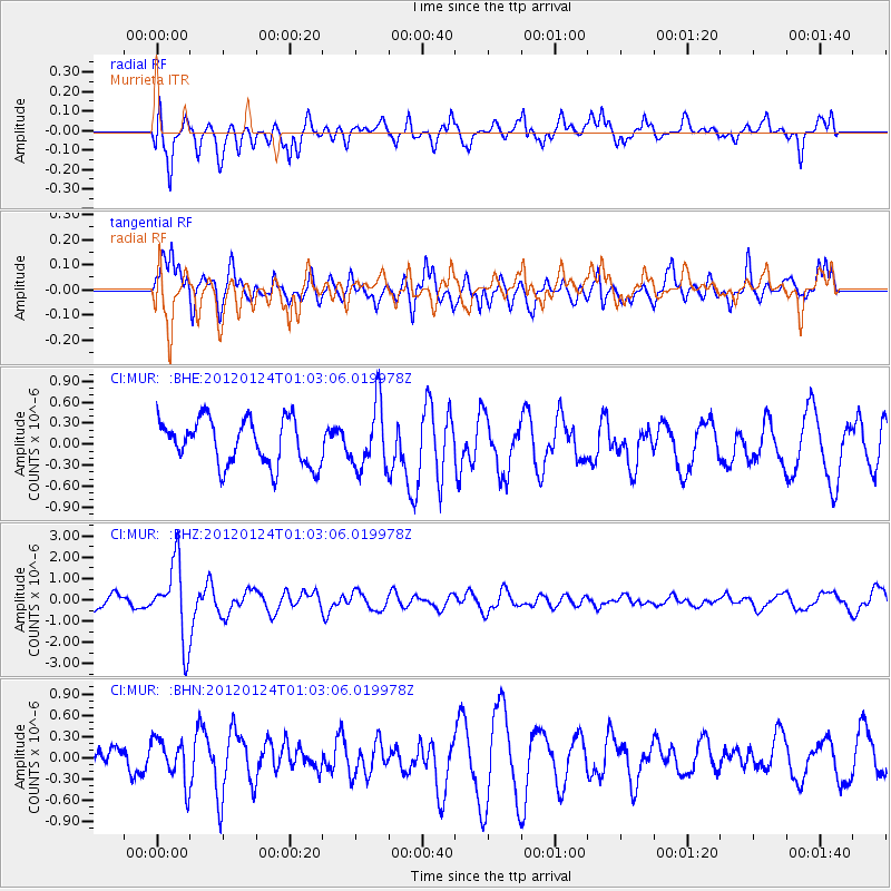
MUR Murrieta - Earthquake Result Viewer
*The percent match for this event was below the threshold and hence no stack was calculated.
| Earthquake location: |
South Of Fiji Islands |
| Earthquake latitude/longitude: |
-25.0/178.5 |
| Earthquake time(UTC): |
2012/01/24 (024) 00:52:05 GMT |
| Earthquake Depth: |
580 km |
| Earthquake Magnitude: |
5.8 MB, 6.3 MW, 6.4 MW |
| Earthquake Catalog/Contributor: |
WHDF/NEIC |
|
| Network: |
CI Caltech Regional Seismic Network |
| Station: |
MUR Murrieta |
| Lat/Lon: |
33.60 N/117.20 W |
| Elevation: |
562 m |
|
| Distance: |
84.4 deg |
| Az: |
49.074 deg |
| Baz: |
235.243 deg |
| Ray Param: |
$rayparam |
*The percent match for this event was below the threshold and hence was not used in the summary stack. |
|
| Radial Match: |
70.155464 % |
| Radial Bump: |
400 |
| Transverse Match: |
69.66293 % |
| Transverse Bump: |
400 |
| SOD ConfigId: |
436445 |
| Insert Time: |
2012-04-05 16:42:15.733 +0000 |
| GWidth: |
2.5 |
| Max Bumps: |
400 |
| Tol: |
0.001 |
|
Signal To Noise
| Channel | StoN | STA | LTA |
| CI:MUR: :BHZ:20120124T01:03:06.019978Z | 5.68063 | 1.7973246E-6 | 3.1639527E-7 |
| CI:MUR: :BHN:20120124T01:03:06.019978Z | 1.522927 | 3.090949E-7 | 2.0296106E-7 |
| CI:MUR: :BHE:20120124T01:03:06.019978Z | 1.394119 | 4.527278E-7 | 3.2474114E-7 |
| Arrivals |
| Ps | |
| PpPs | |
| PsPs/PpSs | |


