You are here: Home > Network List > TA - USArray Transportable Network (new EarthScope stations) Stations List
> Station J05D Fort Rock, OR, USA > Earthquake Result Viewer
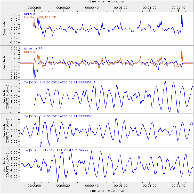
J05D Fort Rock, OR, USA - Earthquake Result Viewer
*The percent match for this event was below the threshold and hence no stack was calculated.
| Earthquake location: |
South Of Fiji Islands |
| Earthquake latitude/longitude: |
-25.0/178.5 |
| Earthquake time(UTC): |
2012/01/24 (024) 00:52:05 GMT |
| Earthquake Depth: |
580 km |
| Earthquake Magnitude: |
5.8 MB, 6.3 MW, 6.4 MW |
| Earthquake Catalog/Contributor: |
WHDF/NEIC |
|
| Network: |
TA USArray Transportable Network (new EarthScope stations) |
| Station: |
J05D Fort Rock, OR, USA |
| Lat/Lon: |
43.28 N/121.23 W |
| Elevation: |
1541 m |
|
| Distance: |
87.6 deg |
| Az: |
39.385 deg |
| Baz: |
232.055 deg |
| Ray Param: |
$rayparam |
*The percent match for this event was below the threshold and hence was not used in the summary stack. |
|
| Radial Match: |
62.524353 % |
| Radial Bump: |
400 |
| Transverse Match: |
66.50048 % |
| Transverse Bump: |
389 |
| SOD ConfigId: |
436445 |
| Insert Time: |
2012-04-05 16:47:45.656 +0000 |
| GWidth: |
2.5 |
| Max Bumps: |
400 |
| Tol: |
0.001 |
|
Signal To Noise
| Channel | StoN | STA | LTA |
| TA:J05D: :BHZ:20120124T01:03:21.099995Z | 2.8075283 | 1.352708E-6 | 4.818146E-7 |
| TA:J05D: :BHN:20120124T01:03:21.099995Z | 0.71370125 | 5.780061E-7 | 8.098712E-7 |
| TA:J05D: :BHE:20120124T01:03:21.099995Z | 0.87704456 | 8.188719E-7 | 9.3367197E-7 |
| Arrivals |
| Ps | |
| PpPs | |
| PsPs/PpSs | |


