You are here: Home > Network List > TA - USArray Transportable Network (new EarthScope stations) Stations List
> Station J01D Myrtle Point, OR, USA > Earthquake Result Viewer
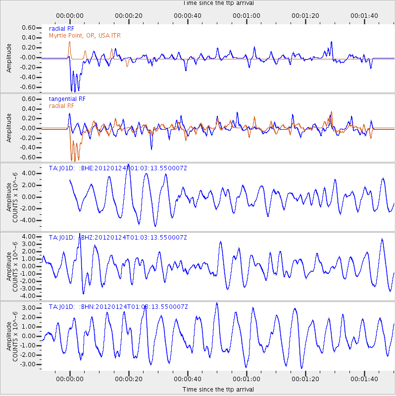
J01D Myrtle Point, OR, USA - Earthquake Result Viewer
*The percent match for this event was below the threshold and hence no stack was calculated.
| Earthquake location: |
South Of Fiji Islands |
| Earthquake latitude/longitude: |
-25.0/178.5 |
| Earthquake time(UTC): |
2012/01/24 (024) 00:52:05 GMT |
| Earthquake Depth: |
580 km |
| Earthquake Magnitude: |
5.8 MB, 6.3 MW, 6.4 MW |
| Earthquake Catalog/Contributor: |
WHDF/NEIC |
|
| Network: |
TA USArray Transportable Network (new EarthScope stations) |
| Station: |
J01D Myrtle Point, OR, USA |
| Lat/Lon: |
43.16 N/123.93 W |
| Elevation: |
131 m |
|
| Distance: |
86.0 deg |
| Az: |
38.242 deg |
| Baz: |
230.15 deg |
| Ray Param: |
$rayparam |
*The percent match for this event was below the threshold and hence was not used in the summary stack. |
|
| Radial Match: |
46.12648 % |
| Radial Bump: |
400 |
| Transverse Match: |
66.06217 % |
| Transverse Bump: |
400 |
| SOD ConfigId: |
436445 |
| Insert Time: |
2012-04-05 16:48:15.847 +0000 |
| GWidth: |
2.5 |
| Max Bumps: |
400 |
| Tol: |
0.001 |
|
Signal To Noise
| Channel | StoN | STA | LTA |
| TA:J01D: :BHZ:20120124T01:03:13.550007Z | 2.2616937 | 2.2196705E-6 | 9.814195E-7 |
| TA:J01D: :BHN:20120124T01:03:13.550007Z | 1.8426912 | 1.405016E-6 | 7.6248045E-7 |
| TA:J01D: :BHE:20120124T01:03:13.550007Z | 1.1758206 | 2.7712742E-6 | 2.3568853E-6 |
| Arrivals |
| Ps | |
| PpPs | |
| PsPs/PpSs | |


