You are here: Home > Network List > TA - USArray Transportable Network (new EarthScope stations) Stations List
> Station TPFO Pinon Flats, CA, USA > Earthquake Result Viewer
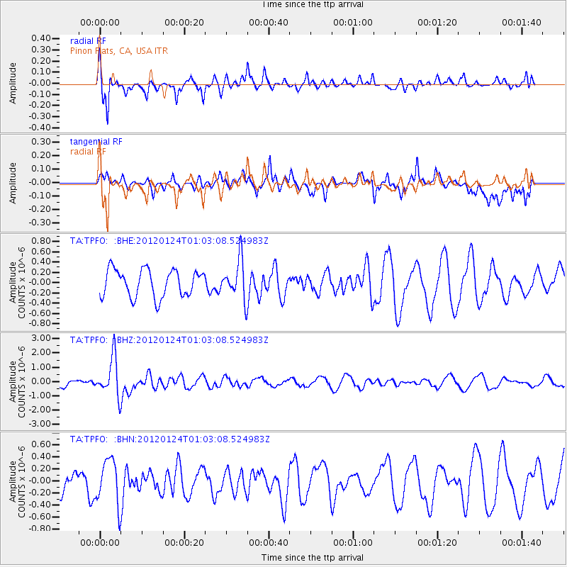
TPFO Pinon Flats, CA, USA - Earthquake Result Viewer
*The percent match for this event was below the threshold and hence no stack was calculated.
| Earthquake location: |
South Of Fiji Islands |
| Earthquake latitude/longitude: |
-25.0/178.5 |
| Earthquake time(UTC): |
2012/01/24 (024) 00:52:05 GMT |
| Earthquake Depth: |
580 km |
| Earthquake Magnitude: |
5.8 MB, 6.3 MW, 6.4 MW |
| Earthquake Catalog/Contributor: |
WHDF/NEIC |
|
| Network: |
TA USArray Transportable Network (new EarthScope stations) |
| Station: |
TPFO Pinon Flats, CA, USA |
| Lat/Lon: |
33.61 N/116.45 W |
| Elevation: |
1275 m |
|
| Distance: |
84.9 deg |
| Az: |
49.421 deg |
| Baz: |
235.683 deg |
| Ray Param: |
$rayparam |
*The percent match for this event was below the threshold and hence was not used in the summary stack. |
|
| Radial Match: |
63.226944 % |
| Radial Bump: |
282 |
| Transverse Match: |
68.66675 % |
| Transverse Bump: |
400 |
| SOD ConfigId: |
436445 |
| Insert Time: |
2012-04-05 16:48:38.044 +0000 |
| GWidth: |
2.5 |
| Max Bumps: |
400 |
| Tol: |
0.001 |
|
Signal To Noise
| Channel | StoN | STA | LTA |
| TA:TPFO: :BHZ:20120124T01:03:08.524983Z | 4.79078 | 1.3831772E-6 | 2.8871648E-7 |
| TA:TPFO: :BHN:20120124T01:03:08.524983Z | 1.0516317 | 3.8353696E-7 | 3.6470655E-7 |
| TA:TPFO: :BHE:20120124T01:03:08.524983Z | 1.4945909 | 3.9644684E-7 | 2.6525444E-7 |
| Arrivals |
| Ps | |
| PpPs | |
| PsPs/PpSs | |


