You are here: Home > Network List > UW - Pacific Northwest Regional Seismic Network Stations List
> Station UMAT Pilot Rock, OR, USA > Earthquake Result Viewer
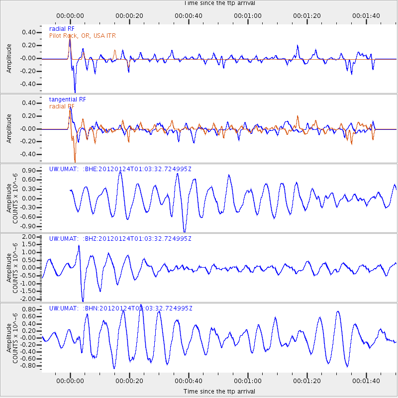
UMAT Pilot Rock, OR, USA - Earthquake Result Viewer
*The percent match for this event was below the threshold and hence no stack was calculated.
| Earthquake location: |
South Of Fiji Islands |
| Earthquake latitude/longitude: |
-25.0/178.5 |
| Earthquake time(UTC): |
2012/01/24 (024) 00:52:05 GMT |
| Earthquake Depth: |
580 km |
| Earthquake Magnitude: |
5.8 MB, 6.3 MW, 6.4 MW |
| Earthquake Catalog/Contributor: |
WHDF/NEIC |
|
| Network: |
UW Pacific Northwest Regional Seismic Network |
| Station: |
UMAT Pilot Rock, OR, USA |
| Lat/Lon: |
45.29 N/118.96 W |
| Elevation: |
1318 m |
|
| Distance: |
90.1 deg |
| Az: |
38.774 deg |
| Baz: |
233.626 deg |
| Ray Param: |
$rayparam |
*The percent match for this event was below the threshold and hence was not used in the summary stack. |
|
| Radial Match: |
83.142845 % |
| Radial Bump: |
357 |
| Transverse Match: |
60.884544 % |
| Transverse Bump: |
400 |
| SOD ConfigId: |
436445 |
| Insert Time: |
2012-04-05 16:49:54.656 +0000 |
| GWidth: |
2.5 |
| Max Bumps: |
400 |
| Tol: |
0.001 |
|
Signal To Noise
| Channel | StoN | STA | LTA |
| UW:UMAT: :BHZ:20120124T01:03:32.724995Z | 2.1062045 | 9.499694E-7 | 4.5103377E-7 |
| UW:UMAT: :BHN:20120124T01:03:32.724995Z | 0.56467205 | 1.8542458E-7 | 3.283757E-7 |
| UW:UMAT: :BHE:20120124T01:03:32.724995Z | 0.695454 | 2.5379347E-7 | 3.649321E-7 |
| Arrivals |
| Ps | |
| PpPs | |
| PsPs/PpSs | |


