You are here: Home > Network List > CI - Caltech Regional Seismic Network Stations List
> Station TIN Tinemaha, Big Pine, CA, USA > Earthquake Result Viewer
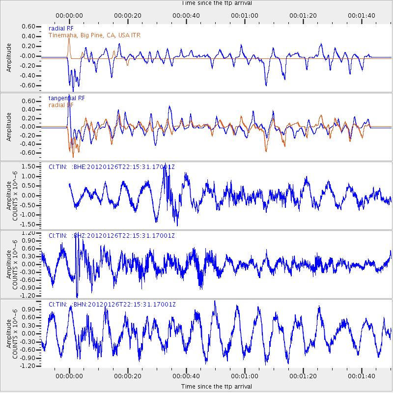
TIN Tinemaha, Big Pine, CA, USA - Earthquake Result Viewer
*The percent match for this event was below the threshold and hence no stack was calculated.
| Earthquake location: |
Mariana Islands Region |
| Earthquake latitude/longitude: |
21.6/142.9 |
| Earthquake time(UTC): |
2012/01/26 (026) 22:04:06 GMT |
| Earthquake Depth: |
314 km |
| Earthquake Magnitude: |
5.5 MB, 5.3 MW |
| Earthquake Catalog/Contributor: |
WHDF/NEIC |
|
| Network: |
CI Caltech Regional Seismic Network |
| Station: |
TIN Tinemaha, Big Pine, CA, USA |
| Lat/Lon: |
37.05 N/118.23 W |
| Elevation: |
1197 m |
|
| Distance: |
84.0 deg |
| Az: |
52.627 deg |
| Baz: |
292.458 deg |
| Ray Param: |
$rayparam |
*The percent match for this event was below the threshold and hence was not used in the summary stack. |
|
| Radial Match: |
75.59806 % |
| Radial Bump: |
400 |
| Transverse Match: |
67.48244 % |
| Transverse Bump: |
400 |
| SOD ConfigId: |
436445 |
| Insert Time: |
2012-04-05 17:00:20.458 +0000 |
| GWidth: |
2.5 |
| Max Bumps: |
400 |
| Tol: |
0.001 |
|
Signal To Noise
| Channel | StoN | STA | LTA |
| CI:TIN: :BHZ:20120126T22:15:31.17001Z | 1.928804 | 5.814068E-7 | 3.0143386E-7 |
| CI:TIN: :BHN:20120126T22:15:31.17001Z | 1.4518013 | 5.44099E-7 | 3.7477514E-7 |
| CI:TIN: :BHE:20120126T22:15:31.17001Z | 2.389682 | 8.9288557E-7 | 3.73642E-7 |
| Arrivals |
| Ps | |
| PpPs | |
| PsPs/PpSs | |


