You are here: Home > Network List > CI - Caltech Regional Seismic Network Stations List
> Station SMM Simmler, CA, USA > Earthquake Result Viewer
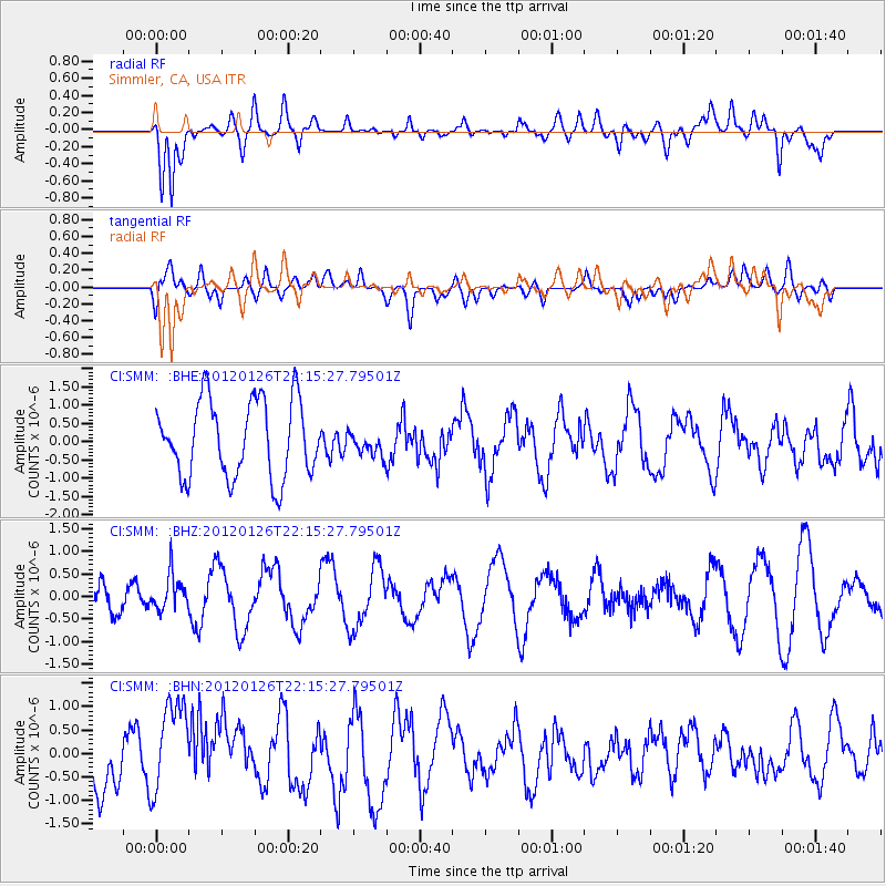
SMM Simmler, CA, USA - Earthquake Result Viewer
*The percent match for this event was below the threshold and hence no stack was calculated.
| Earthquake location: |
Mariana Islands Region |
| Earthquake latitude/longitude: |
21.6/142.9 |
| Earthquake time(UTC): |
2012/01/26 (026) 22:04:06 GMT |
| Earthquake Depth: |
314 km |
| Earthquake Magnitude: |
5.5 MB, 5.3 MW |
| Earthquake Catalog/Contributor: |
WHDF/NEIC |
|
| Network: |
CI Caltech Regional Seismic Network |
| Station: |
SMM Simmler, CA, USA |
| Lat/Lon: |
35.31 N/120.00 W |
| Elevation: |
599 m |
|
| Distance: |
83.3 deg |
| Az: |
54.786 deg |
| Baz: |
291.658 deg |
| Ray Param: |
$rayparam |
*The percent match for this event was below the threshold and hence was not used in the summary stack. |
|
| Radial Match: |
69.07122 % |
| Radial Bump: |
400 |
| Transverse Match: |
29.845018 % |
| Transverse Bump: |
400 |
| SOD ConfigId: |
436445 |
| Insert Time: |
2012-04-05 17:00:59.107 +0000 |
| GWidth: |
2.5 |
| Max Bumps: |
400 |
| Tol: |
0.001 |
|
Signal To Noise
| Channel | StoN | STA | LTA |
| CI:SMM: :BHZ:20120126T22:15:27.79501Z | 1.2037479 | 3.8728166E-7 | 3.2172989E-7 |
| CI:SMM: :BHN:20120126T22:15:27.79501Z | 1.7589059 | 1.081259E-6 | 6.1473384E-7 |
| CI:SMM: :BHE:20120126T22:15:27.79501Z | 0.29948437 | 3.1410133E-7 | 1.048807E-6 |
| Arrivals |
| Ps | |
| PpPs | |
| PsPs/PpSs | |


