You are here: Home > Network List > G - GEOSCOPE Stations List
> Station HYB Hyderabad, India > Earthquake Result Viewer
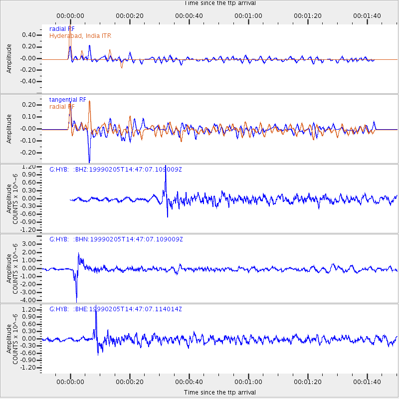
HYB Hyderabad, India - Earthquake Result Viewer
*The percent match for this event was below the threshold and hence no stack was calculated.
| Earthquake location: |
Northwest Of Kuril Islands |
| Earthquake latitude/longitude: |
47.5/147.2 |
| Earthquake time(UTC): |
1999/02/05 (036) 14:37:53 GMT |
| Earthquake Depth: |
407 km |
| Earthquake Magnitude: |
6.0 MW, 5.4 MB, 5.8 MW |
| Earthquake Catalog/Contributor: |
WHDF/NEIC |
|
| Network: |
G GEOSCOPE |
| Station: |
HYB Hyderabad, India |
| Lat/Lon: |
17.42 N/78.55 E |
| Elevation: |
510 m |
|
| Distance: |
62.9 deg |
| Az: |
266.504 deg |
| Baz: |
45.139 deg |
| Ray Param: |
$rayparam |
*The percent match for this event was below the threshold and hence was not used in the summary stack. |
|
| Radial Match: |
72.81131 % |
| Radial Bump: |
400 |
| Transverse Match: |
79.68596 % |
| Transverse Bump: |
400 |
| SOD ConfigId: |
4480 |
| Insert Time: |
2010-02-26 23:04:35.995 +0000 |
| GWidth: |
2.5 |
| Max Bumps: |
400 |
| Tol: |
0.001 |
|
Signal To Noise
| Channel | StoN | STA | LTA |
| G:HYB: :BHN:19990205T14:47:07.109009Z | 12.899887 | 1.1300875E-6 | 8.7604455E-8 |
| G:HYB: :BHE:19990205T14:47:07.114014Z | 1.3635228 | 5.8007526E-8 | 4.25424E-8 |
| G:HYB: :BHZ:19990205T14:47:07.109009Z | 7.148235 | 3.1987284E-7 | 4.474851E-8 |
| Arrivals |
| Ps | |
| PpPs | |
| PsPs/PpSs | |


