You are here: Home > Network List > TA - USArray Transportable Network (new EarthScope stations) Stations List
> Station I33A Coleman, SD, USA > Earthquake Result Viewer
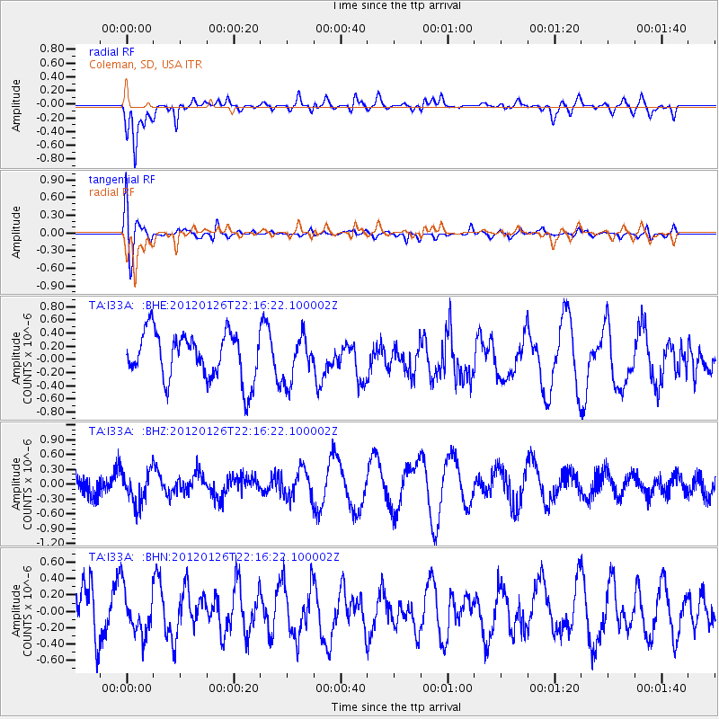
I33A Coleman, SD, USA - Earthquake Result Viewer
*The percent match for this event was below the threshold and hence no stack was calculated.
| Earthquake location: |
Mariana Islands Region |
| Earthquake latitude/longitude: |
21.6/142.9 |
| Earthquake time(UTC): |
2012/01/26 (026) 22:04:06 GMT |
| Earthquake Depth: |
314 km |
| Earthquake Magnitude: |
5.5 MB, 5.3 MW |
| Earthquake Catalog/Contributor: |
WHDF/NEIC |
|
| Network: |
TA USArray Transportable Network (new EarthScope stations) |
| Station: |
I33A Coleman, SD, USA |
| Lat/Lon: |
44.05 N/96.80 W |
| Elevation: |
509 m |
|
| Distance: |
94.9 deg |
| Az: |
38.648 deg |
| Baz: |
306.317 deg |
| Ray Param: |
$rayparam |
*The percent match for this event was below the threshold and hence was not used in the summary stack. |
|
| Radial Match: |
74.34322 % |
| Radial Bump: |
400 |
| Transverse Match: |
53.87112 % |
| Transverse Bump: |
400 |
| SOD ConfigId: |
436445 |
| Insert Time: |
2012-04-05 17:06:17.386 +0000 |
| GWidth: |
2.5 |
| Max Bumps: |
400 |
| Tol: |
0.001 |
|
Signal To Noise
| Channel | StoN | STA | LTA |
| TA:I33A: :BHZ:20120126T22:16:22.100002Z | 0.7917853 | 3.272658E-7 | 4.1332646E-7 |
| TA:I33A: :BHN:20120126T22:16:22.100002Z | 0.61463434 | 2.605302E-7 | 4.2387836E-7 |
| TA:I33A: :BHE:20120126T22:16:22.100002Z | 0.9373578 | 3.349408E-7 | 3.573244E-7 |
| Arrivals |
| Ps | |
| PpPs | |
| PsPs/PpSs | |


