You are here: Home > Network List > UW - Pacific Northwest Regional Seismic Network Stations List
> Station MRBL Marblemount, WA, USA > Earthquake Result Viewer
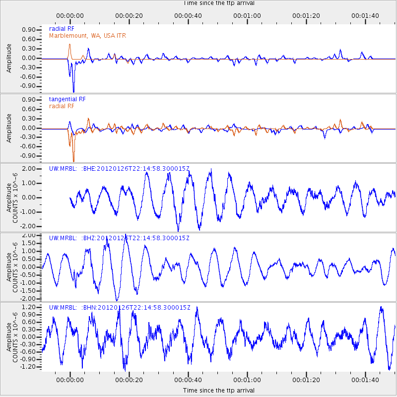
MRBL Marblemount, WA, USA - Earthquake Result Viewer
*The percent match for this event was below the threshold and hence no stack was calculated.
| Earthquake location: |
Mariana Islands Region |
| Earthquake latitude/longitude: |
21.6/142.9 |
| Earthquake time(UTC): |
2012/01/26 (026) 22:04:06 GMT |
| Earthquake Depth: |
314 km |
| Earthquake Magnitude: |
5.5 MB, 5.3 MW |
| Earthquake Catalog/Contributor: |
WHDF/NEIC |
|
| Network: |
UW Pacific Northwest Regional Seismic Network |
| Station: |
MRBL Marblemount, WA, USA |
| Lat/Lon: |
48.52 N/121.48 W |
| Elevation: |
75 m |
|
| Distance: |
77.7 deg |
| Az: |
42.621 deg |
| Baz: |
288.647 deg |
| Ray Param: |
$rayparam |
*The percent match for this event was below the threshold and hence was not used in the summary stack. |
|
| Radial Match: |
81.94984 % |
| Radial Bump: |
400 |
| Transverse Match: |
42.686672 % |
| Transverse Bump: |
400 |
| SOD ConfigId: |
436445 |
| Insert Time: |
2012-04-05 17:08:22.819 +0000 |
| GWidth: |
2.5 |
| Max Bumps: |
400 |
| Tol: |
0.001 |
|
Signal To Noise
| Channel | StoN | STA | LTA |
| UW:MRBL: :BHZ:20120126T22:14:58.300015Z | 1.1082617 | 5.190239E-7 | 4.683225E-7 |
| UW:MRBL: :BHN:20120126T22:14:58.300015Z | 0.7825215 | 5.4077833E-7 | 6.9107153E-7 |
| UW:MRBL: :BHE:20120126T22:14:58.300015Z | 1.9062531 | 1.1355307E-6 | 5.956873E-7 |
| Arrivals |
| Ps | |
| PpPs | |
| PsPs/PpSs | |


