You are here: Home > Network List > TA - USArray Transportable Network (new EarthScope stations) Stations List
> Station J04D Umpqua National Forest, Toketee, OR, USA > Earthquake Result Viewer
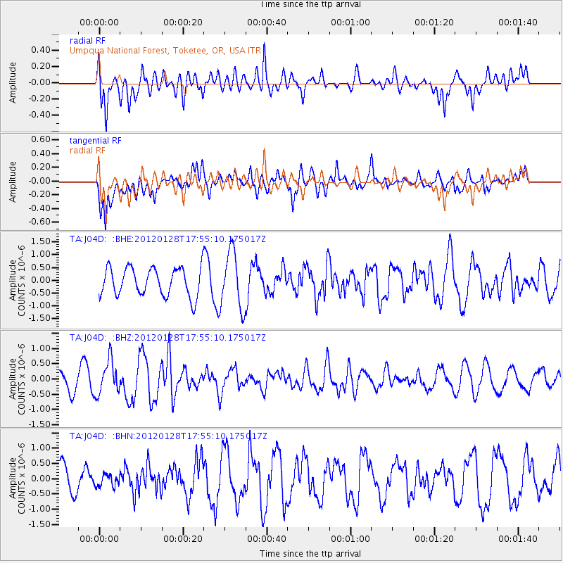
J04D Umpqua National Forest, Toketee, OR, USA - Earthquake Result Viewer
*The percent match for this event was below the threshold and hence no stack was calculated.
| Earthquake location: |
Kermadec Islands, New Zealand |
| Earthquake latitude/longitude: |
-29.4/-177.4 |
| Earthquake time(UTC): |
2012/01/28 (028) 17:42:51 GMT |
| Earthquake Depth: |
21 km |
| Earthquake Magnitude: |
5.8 MB, 5.6 MS, 5.9 MW, 5.8 MW |
| Earthquake Catalog/Contributor: |
WHDF/NEIC |
|
| Network: |
TA USArray Transportable Network (new EarthScope stations) |
| Station: |
J04D Umpqua National Forest, Toketee, OR, USA |
| Lat/Lon: |
43.24 N/122.11 W |
| Elevation: |
1948 m |
|
| Distance: |
88.3 deg |
| Az: |
36.934 deg |
| Baz: |
225.833 deg |
| Ray Param: |
$rayparam |
*The percent match for this event was below the threshold and hence was not used in the summary stack. |
|
| Radial Match: |
67.789 % |
| Radial Bump: |
400 |
| Transverse Match: |
79.161865 % |
| Transverse Bump: |
400 |
| SOD ConfigId: |
436445 |
| Insert Time: |
2012-04-05 17:31:27.709 +0000 |
| GWidth: |
2.5 |
| Max Bumps: |
400 |
| Tol: |
0.001 |
|
Signal To Noise
| Channel | StoN | STA | LTA |
| TA:J04D: :BHZ:20120128T17:55:10.175017Z | 1.4726523 | 5.60784E-7 | 3.8079864E-7 |
| TA:J04D: :BHN:20120128T17:55:10.175017Z | 0.33558294 | 1.9492138E-7 | 5.8084413E-7 |
| TA:J04D: :BHE:20120128T17:55:10.175017Z | 2.0088623 | 1.1078489E-6 | 5.514808E-7 |
| Arrivals |
| Ps | |
| PpPs | |
| PsPs/PpSs | |


